Images
Information
Description
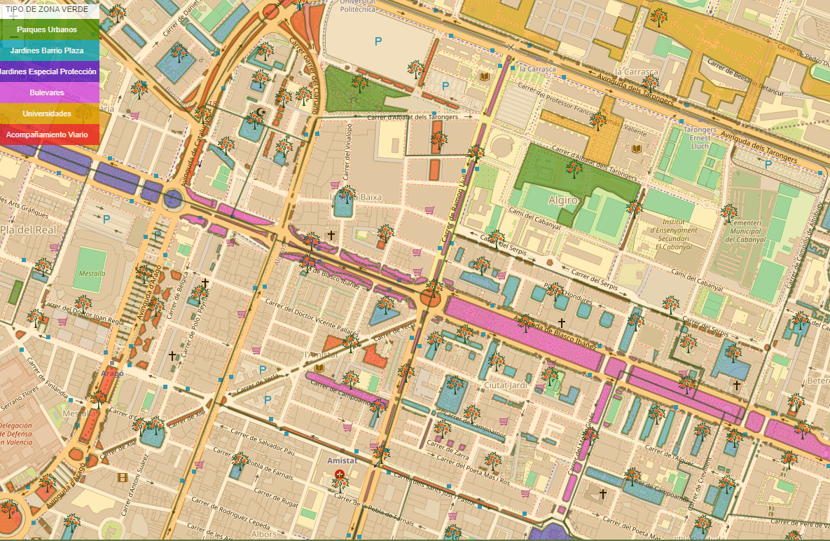
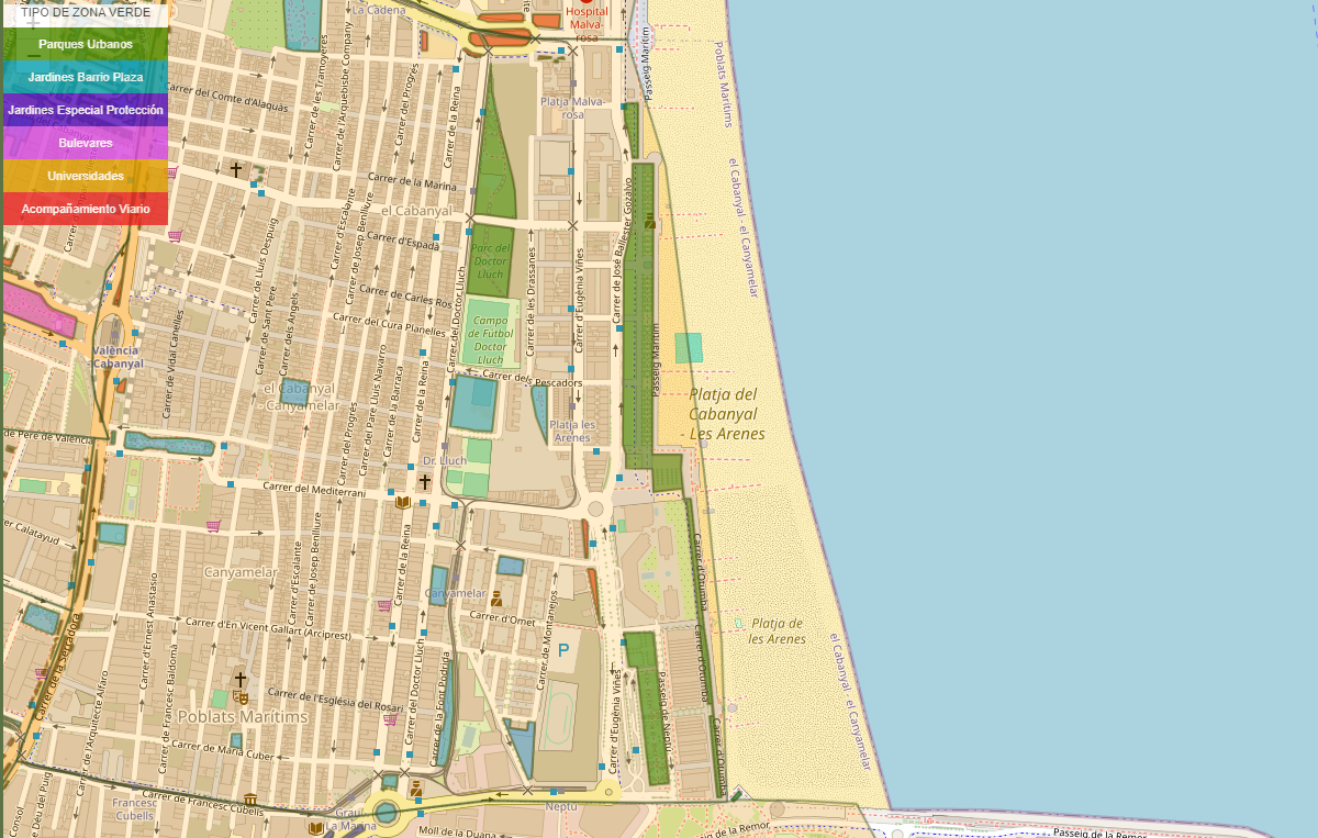
It is a website that reuses open data to report on how green spaces and trees are distributed in the city of Valencia.
The information on the website is divided into three areas:
- Valencia city
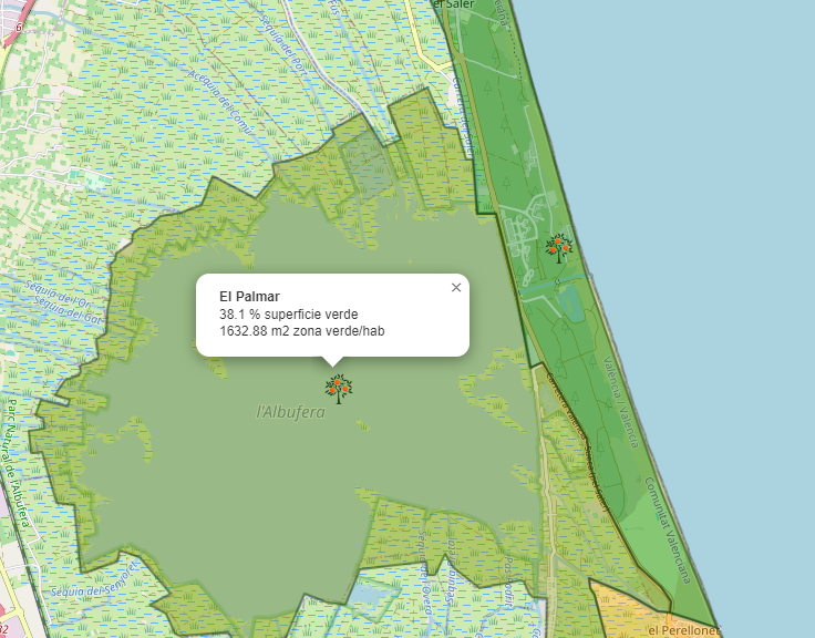
- Municipal area of Valencia
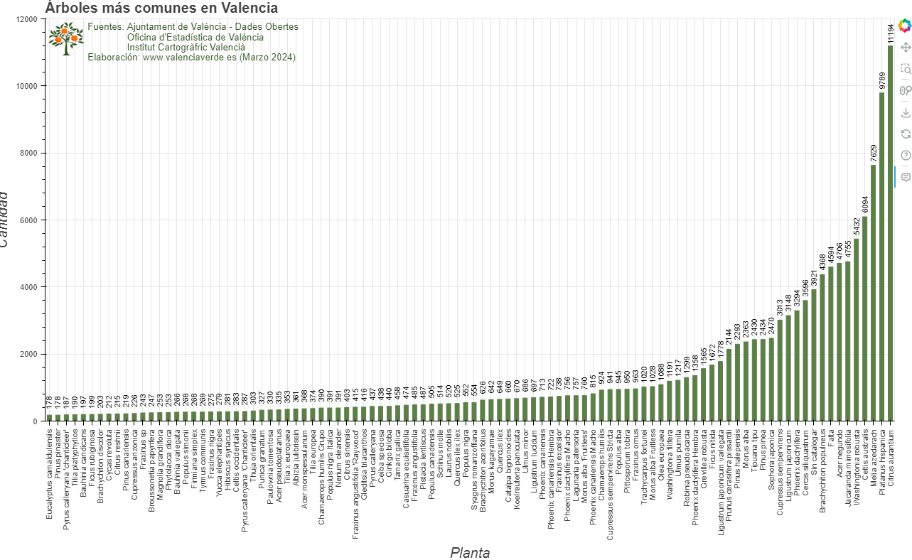
- Data on trees in Valencia city
The data shown on Valencia Verde comes from open data catalogs on green spaces and trees available at Ajuntament de València - Dades Obertes, census data from the Oficina d'Estadística de València and information from the Institut Cartogràfric Valencià.
The last date for obtaining the aforementioned data, and for updating this website, is March 2024.
Thanks to this information, visualizations are created in which users can see, for example, the percentage of green area per neighborhood/district and the m2 of green area per inhabitant in each neighborhood/district. This application is a space that allows to know, in a clear and interactive way, the trees, green areas and their relationship with the population and neighborhoods of Valencia.