


Documentation
2 documents found
Audience:
-
How to use OGC APIs to enhance geospatial data interoperability

In a world where geospatial information is crucial to address global challenges such as climate change and natural resource management, interoperability and the creation of standards are essential. Interoperability facilitates collaboration between...
-
Infographics: Guidelines for publication and reuse
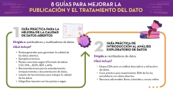
In this article we compile a series of infographics aimed at both publishers and reusers working with open data. They show standards and good practices to facilitate both the publication and the processing of data. 1. Guide for the deployment of data...


