Applications of [open] data science for agriculture
Fecha de la noticia: 10-07-2018
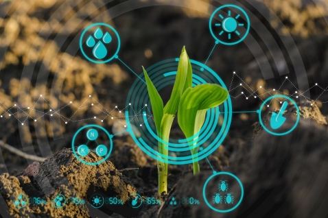
In many areas, there is a false belief that the primary sector is a technologically backward sector that is not involved in digitization. Perhaps because throughout history, as economic development indicators progressed, their weight in GDP and employment rates has been decreasing in favor of other sectors.
However, the agricultural sector is once again gaining prominence, as it currently faces a set of challenges that are closely related to the future of humanity. Climate change, food security and population growth are just some of the most challenging. The European Commission itself, through the Horizon 2020 program, is allocating important research resources to the social challenge of food security, sustainable agriculture, marine and maritime research, and bioeconomy.
As in other industries, digital transformation is helping to change the operating bases of the agricultural sector, giving rise to what is already known as smart agriculture or precision agriculture, which is also a very important part of the solution to the mentioned challenges.
The agricultural sector is increasingly combining technologies, such as geolocation, soil and environmental conditions monitoring, artificial intelligence, cloud computing and Internet of Things (IoT), to accurately measure the variations of numerous variables in the crop fields and thus improve the quantity and quality of agricultural products.
As in many other industries, the base of digital transformation is data: open, private or enriched with each other, with data science in a leading role. Data science helps farmers see and understand what is happening in their fields with unprecedented precision, allowing them to make much more sustainable decisions to get an efficient production.
From seeds genetics to environmental conditions -and not only weather, but also any issue that affects agricultural production- can be measured and analyzed in order to make sustainable decisions.
Since we know that small variations in the quantities of materials selectively used at specific times and places can generate huge differences in crop yields, farmers can use data science to decide the right amount of seeds that should be planted in a field or the amount of water, fertilizers or pesticides needed to maximize the seeds yield and minimize environmental damage.
To be real, these applications need to combine open data with internal data coming from the sensorization of the crop fields or aerial images from drones or satellites.
Given the importance of the topic, the Open Data Charter, through the Global Open Data for Agriculture and Nutrition (GODAN) initiative, and as part of the Agriculture Open Data Package (AgPack), has classified the key datasets that public administrations handle and whose opening would have an important impact for the agricultural sector into 14 categories, which are explained in the following figure.
In the figure we find from evident data sets, such as those that contain meteorological, hydrological or geographical data, to others that are useful for multiple sectors besides agriculture, such as imports, exports, prices or quality standards of agricultural products. And of course, data on allowed pesticides, inspections or legislative texts related to one of the most regulated sectors of our economy. GODAN has produced important informative material like this or this webinar about Agpack.
| Main group | Category | Description | Example |
|---|---|---|---|
|
Administration and legislation
data
|
Government, agricultural law and regulations
|
Policy and legislation texts relevantfor the agricultural sector
|
Subsidy schemes; animal health and welfare regulations; import/export regulations; environmental regulations; (phyto) sanitary regulations
|
| Official records |
Lists of organisations, people or products officially registered,permitted or restricted as a resultof legislation
|
Permitted pesticides; (import/export) tariffs; (safety) inspectionresults; approved permits; licensed organisations(corporations, businesses, NGOs); land registration
|
|
|
Government finance data
|
Data on the financial management of the government, budgets, spending
|
Penalties given to agricultural actors; agriculture-related tax income; agricultural subsidy expenditure
|
|
|
Rural development project data
|
Data describing rural development (RD) projects funded by a government. This may be the local government or a donor government (aid)
|
Rural development project documents; rural development project baseline and survey data; rural development project output, outcome and impact; general information on a rural development project
|
|
|
Socio-economic data
|
Land use data and productivity data
|
Data describing the land use, crop types and production of an area or region
|
Biomass; crop yield; cultivated crops and livestock; land use data
|
| Value chain data |
Data describing the value chain and its activities
|
(Food) product data; company profiles of groups of value chain actors or organisations; (food safety) inspection results
|
|
| Infrastructure data |
Data describing national networks for roads, water, ICT, including their condition and maintenance
|
Internet coverage; waterways; road management
schedules; mobile telephone coverage; road network |
|
| Market data |
Data on the location of markets, market prices, market standards
|
Import/export volume; lists of markets and auctions; market prices; global food prices; location of markets; standards, grades, labelling; market management and rules
|
|
|
Natural resources, earth and
environment data
|
Meteorological data
|
Quantitative data on weather and climate
|
Climate change predictions; climate zones; observations
archives; real-time observations; short-term weather forecast |
| Elevation data |
Data describing the elevation of the
terrain and its derivates |
Digital elevation model; height points; slope data;
aspect data
|
|
|
Hydrological data
|
Data describing the state and dynamics of ground and surface water
|
Water management; water tables; water quality; real-time water levels; historical records on flooding; flood zones; water balance; location of water sources
|
|
| Soil data | Data describing soil properties |
Soil classes; soil samples; soil maps |
|
|
Agronomic data, agricultural technologies
|
Production advice
|
Data related to crop selection, crop and land management
|
Fertilizer recommendations; intercropping, relay cropping and rotations; agronomic practice recommendations; crop calendars; data on cultivars, land races and farmer varieties including new releases
|
|
Pest and disease management data
|
Data on the distribution of pests and diseases and their treatment
|
Occurrences and distribution of plant diseases; treatment of plant diseases; recommended pesticides
|
To interpret this table to design appropriate policies, it is necessary to bear in mind that we are faced with very diverse data sets. In some countries, these data sets are managed by public administrations, while in others they could be in the hands of private initiatives, because agricultural data are not exclusive to public or private organizations.
Like the big companies that operate in different parts of the sector's value chain, such as John Dere or Monsanto (now Bayer), which have been working for years to create tools to collect and analyze data on farmland and resources, Public administrations also have a possible roadmap to plan their data opening policies in the agricultural sector.
Undoubtedly, the combination of public and private efforts to advance the collection, opening and enrichment of data with impact on the agricultural sector activities will contribute to the development of a greater number of applications that can be used to improve the productivity of the sector, the food security and the environmental sustainability.
Content prepared by Jose Luis Marín, Head of Corporate Technology Startegy en MADISON MK and Euroalert CEO.
Contents and points of view expressed in this publication are the exclusive responsibility of its author.


