Publication date
28/03/2018
Update date
20/06/2024

Description
In recent years, the opening of geographic data has allowed citizens and companies to better understand their environment, through maps and visualizations such as those included in the SignA portal of the National Geographic Institute or the digital Atlas of urban areas of the Ministry of Development. In addition, geographic data has also been reused by individuals and companies, who have dared to create from applications in order to know forest fires situation to strategy games, and many more applications.
The democratization of geographic datasets is becoming, therefore, increasingly evident. But there is not an official definition to facilitate standardization and data interoperability, which would further promote its publication and reuse. For this reason, the Spanish Association for Standardization (AENOR) has recently published Spanish Standard UNE 148004: 2018 "Open Geographic Data". This Standard was defined and approved by the Technical Standardization Committee 148 "Digital geographic information", after a process of public hearing, with the aim of providing a standardized definition of geographic open data that allows generating certification mechanisms.
Defining what is a geographic dataset was relatively easy. According to the text, geographic data are those "that implicitly or explicitly refer to an Earth´s location. However, defining open data is a little longer and more complex.
The open data explanation elaborated by CTN 148 is based on multiple sources, although one of its main pillars is the definition established by Open Knowledge International and published at http://opendefinition.org/. The Spanish Standard UNE 148004: 2018 enriches this definition based on 3 principles:
- Principle of barriers minimization: Data must be made available to citizens freely, avoiding any technical, administrative or legal barrier that prevents or limits their use.
- Principle of non-discrimination: Data access conditions must be equal for all users, without any privileges for particular user groups.
- Principle of technological neutrality: According to National Interoperability Scheme, described by RD 4/2010, of January 8, 2010, it is necessary to use open standards, which operate independently of the operating system and any communications or software layer. This helps to avoid users discrimination by technology - as the previous principle indicates-.
Once these principles are defined, the UNE 148004: 2018 Standard details what requirements open geographic data must meet. In accordance with the Standard, geographic data could be considered as “open” if they are:
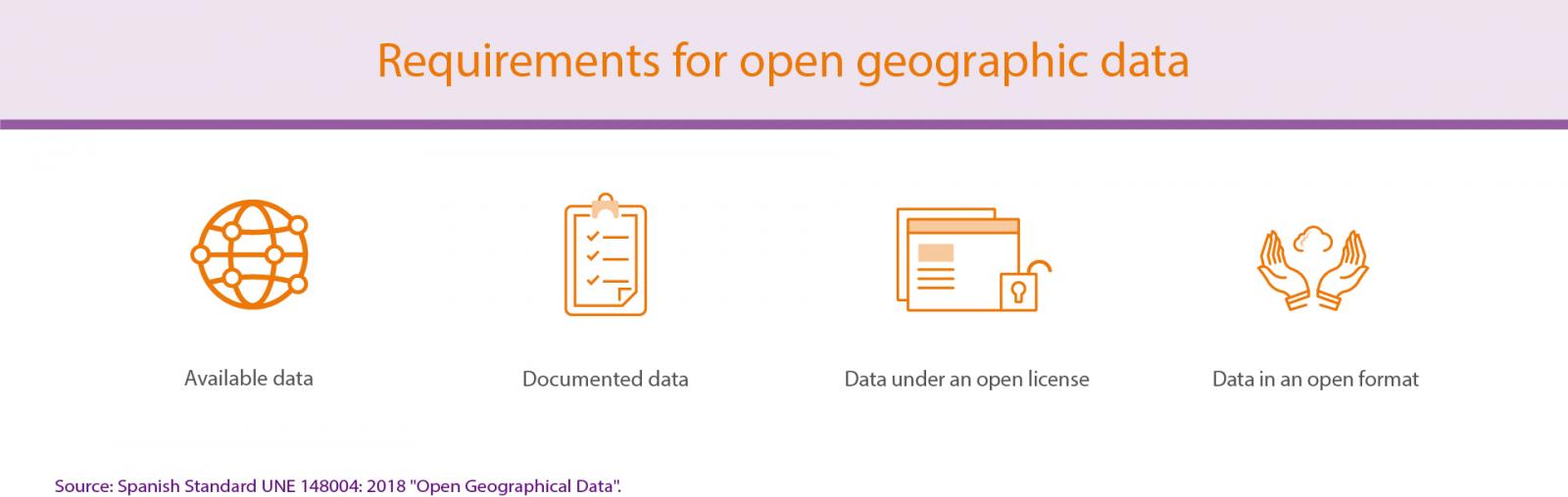
Below is a detail of each of these requirements:
- Available data: geographic open data must be available on the internet for total or partial download, free or at very low cost (with a price that covers the marginal cost of its preparation and publication).
- Documented data: it is essential to use descriptive metadata that facilitate data interpretation in a univocal way. These metadata should include information about language, coding system format, date of update and coordinate reference system (SRC).
- Data under an open license: open geographic data must be published under a standard open license, which has a clear, well-known public definition. This license implies its implicit acceptance with the mere download of the information, without discrimination. In addition, it must be non-revocable and universal, and must allow data exploitation, as a whole or in part, whatever the user's purpose.
- Data in an open format: geographic open data must be published in a digital format that allows the information to be processed automatically for its free use, irrevocably and without restrictions. In addition, it is important to include a complete technical description and, at least, one free software application would be able to process the complete standard. Finally, it is recommended that an open and participatory general interest organization approves the format.
The fact that these requirements facilitate to determine if a geographic dataset is open or not is a useful guide for all those public organizations that want to open this kind of information, facilitating standardization and interoperability. UNE 148004: 2018 "Open geographic data" is, therefore, a necessary standard. We hope it will promote the open geographic data publication and facilitate its exploitation and reuse.
Comments