Images


Information
Description
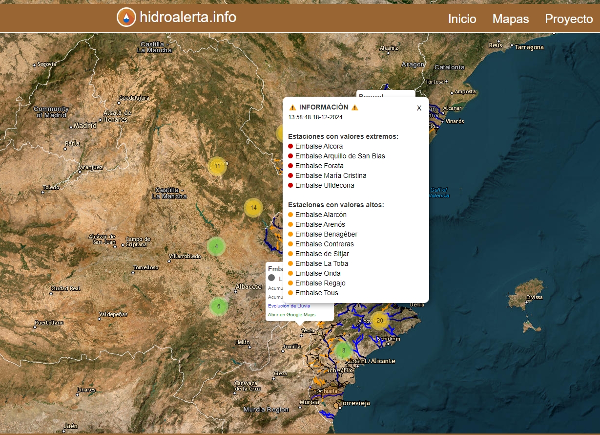
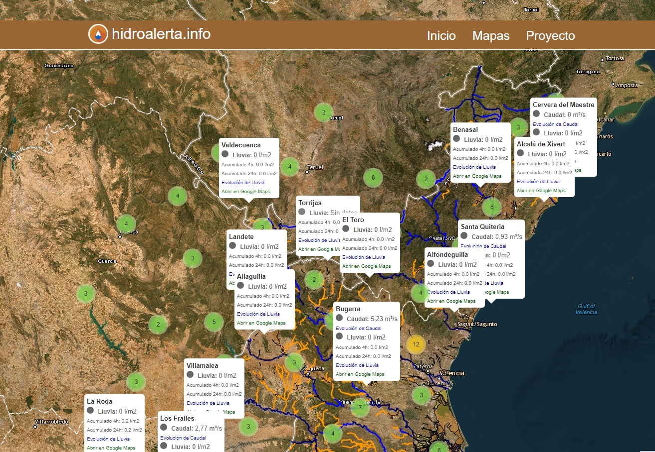
Hidroalerta is an interactive map that provides real-time information on the flow of rivers and wadis, the volume of water in reservoirs and rainfall in the Valencian Community. It is accessible in web and mobile versions.
Through an interactive map it is possible to view and consult the following parameters:
- Flow rate of rivers and wadis (m3/sec).
- Volume of water in reservoirs (Hm3)
- Rainfall (l/m2)
The information is updated every 30 minutes from the Automatic Hydrological Information System (SAIH) of the Júcar Hydrographic Confederation (CHJ).
The map includes:
- Rivers (blue colour) and wadis (orange colour) from the COPUT-1998 file of the Institut Cartogràfic Valencià.
- Areas with Significant Potential Risk of Flooding (ARPSI), from the CHJ.
The desktop version of the map includes more layers of information, such as the hazard classification of flood zones, geomorphology of the terrain or floodable stretches.
Hidroalerta was created in response to the flood that took place on 29 October 2024, which affected several towns in the south of Valencia. Its objective is to serve as a prevention tool through real-time water information of the environment.