
Images
Information
Description
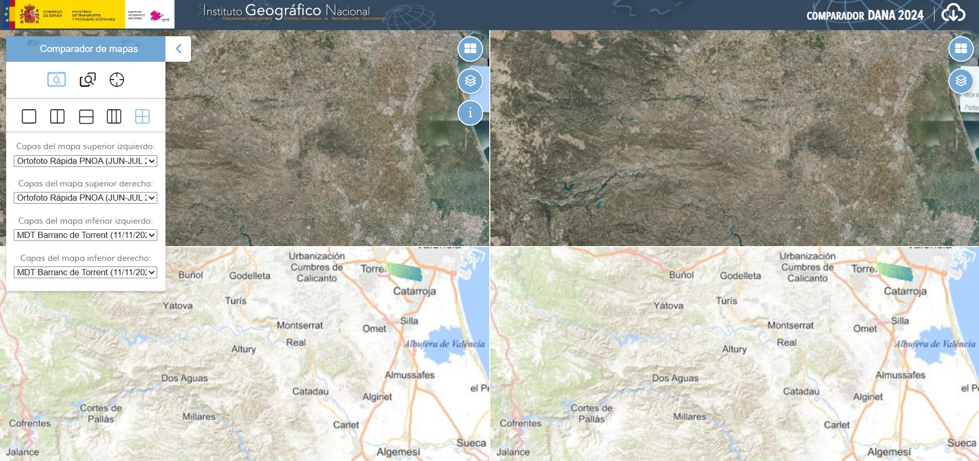
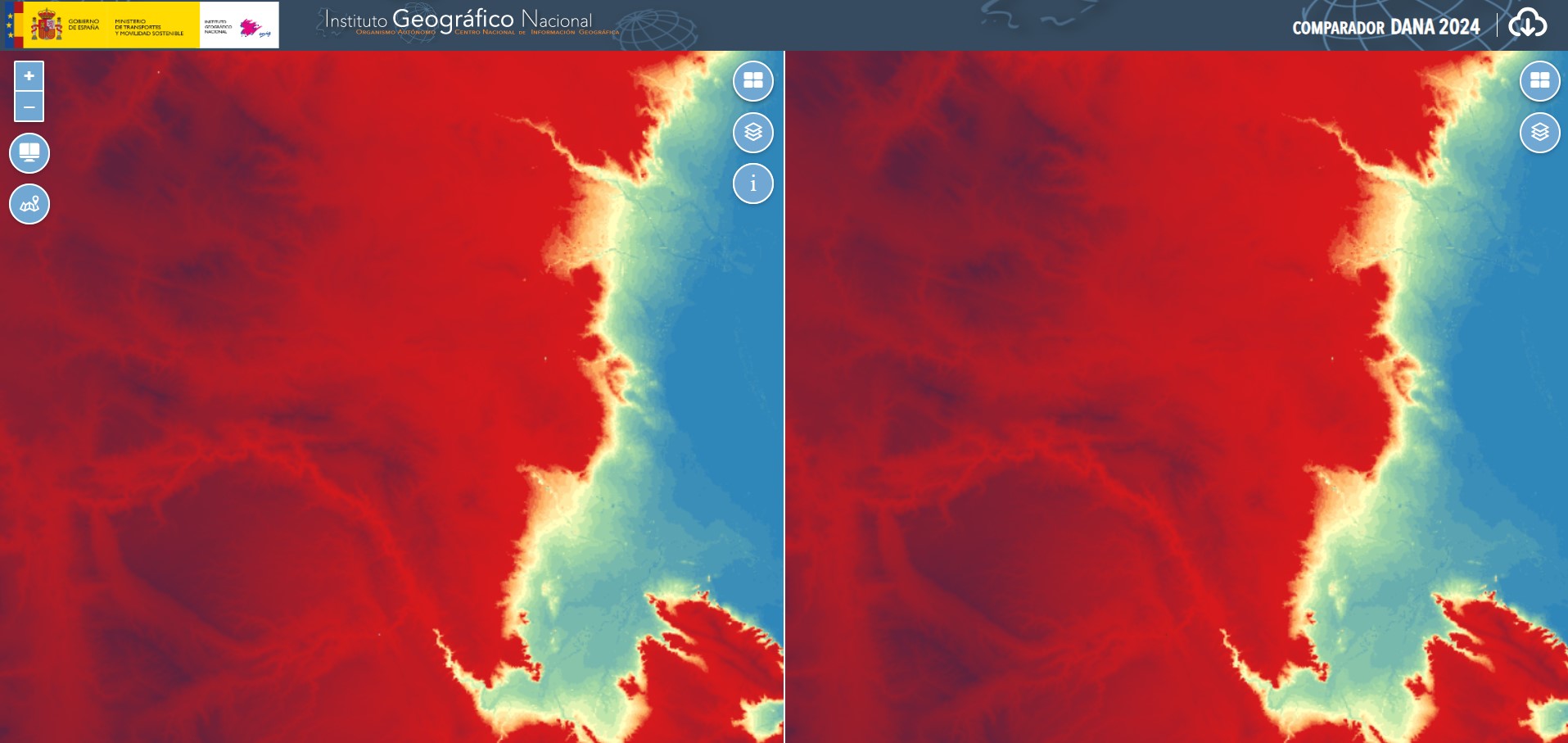
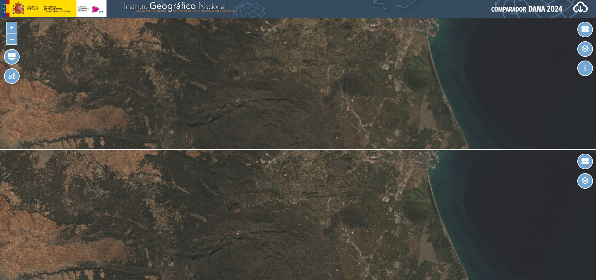
The National Geographic Information Center (CNIG) has developed this tool to compare information on the territory affected by the DANA on October 29, 2024.
The viewer allows users to observe changes in the territory before and after the event. Users can choose different layers: orthophotos, satellite images (from Sentinel), Digital Elevation Models, and Digital Surface Models.
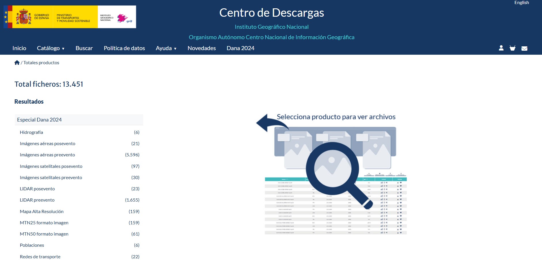
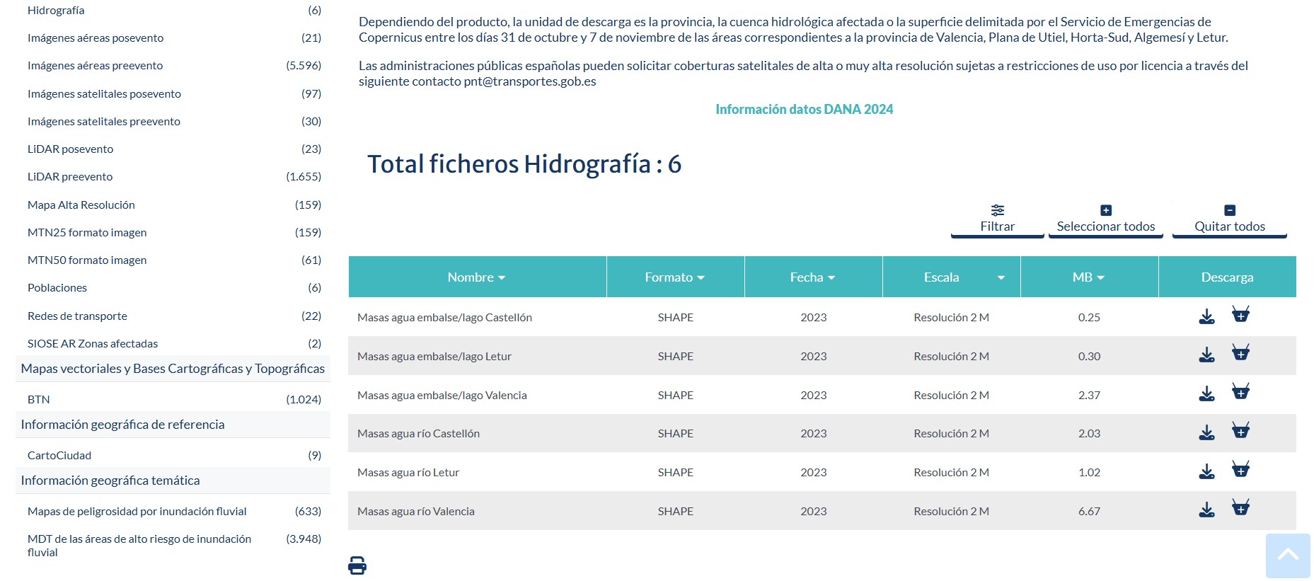
The Download Center can be accessed from the viewer.