

Images
Information
Description
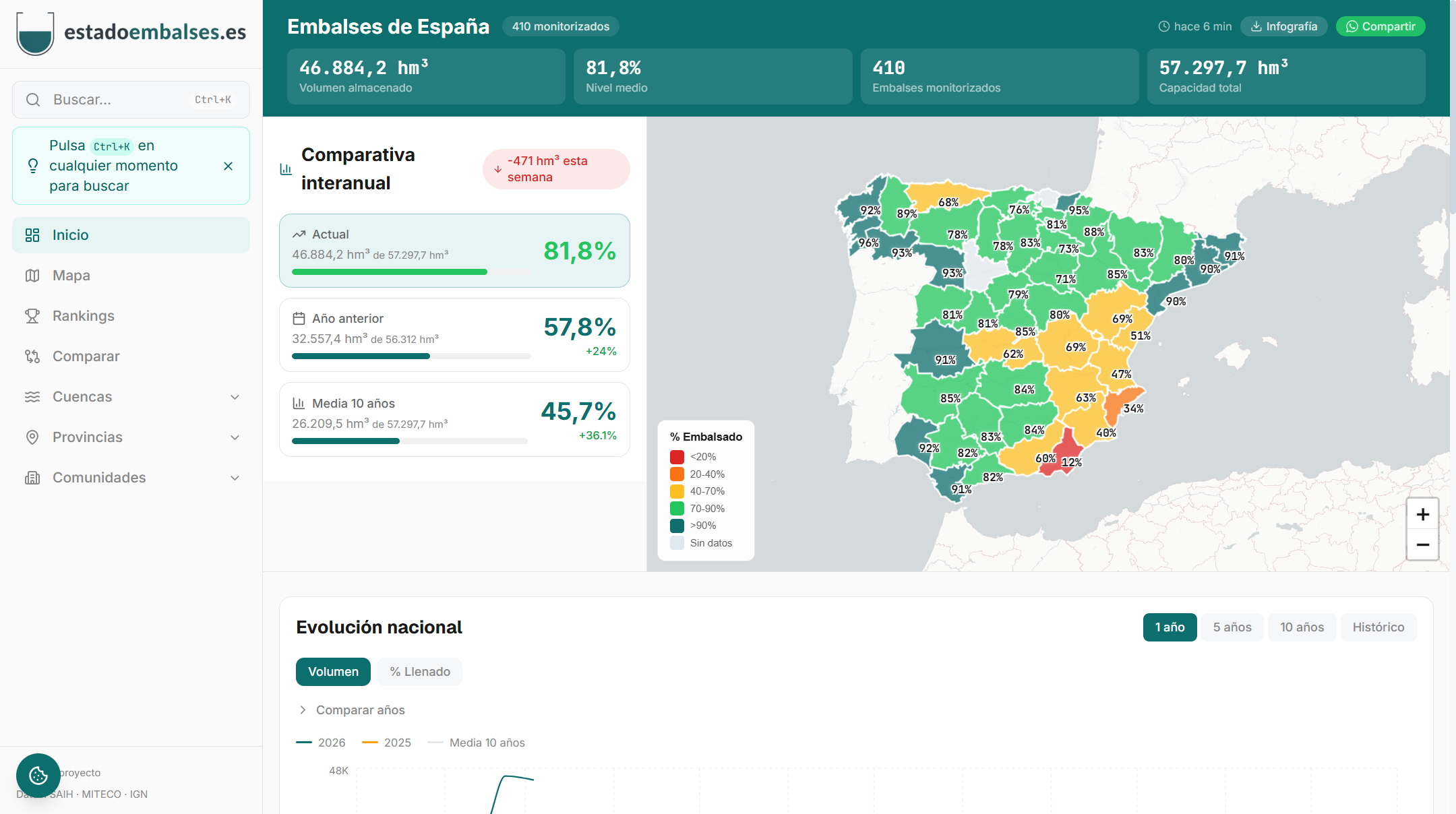
embalses.es is a free web platform that gathers, integrates and visualises in real time the hydrological data of the 449 reservoirs in Spain. It is aimed at farmers, fishermen, professionals in the hydrological sector, environmental researchers, data journalists and anyone interested in the state of water resources in Spain.
The project was born with the aim of facilitating citizen access to hydrological information, currently dispersed in multiple institutional portals, integrating it into a single modern, fast and accessible interface. The information is automatically updated every 15 minutes from official sources, such as the Ministry for the Ecological Transition and the Demographic Challenge (MITECO) and the 13 SAIH systems of the hydrographic confederations.
Main functionalities
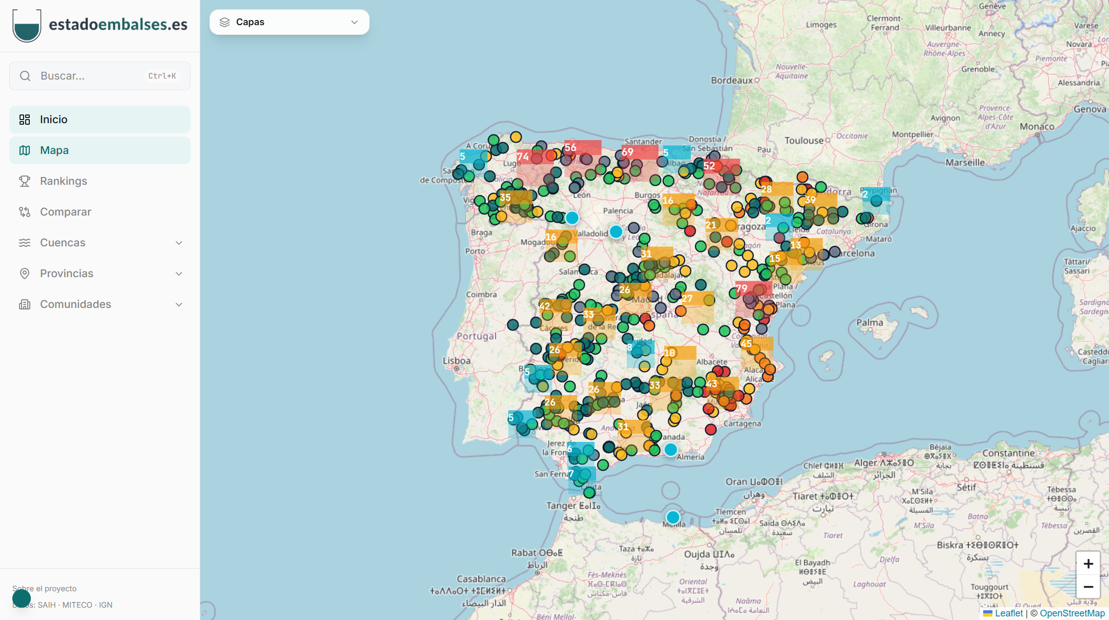
- Interactive choropletic map by basins and provinces with real-time fill levels.
- Interactive historical graphs with zoom, selection of up to 8 years and comparison with the 10-year average.
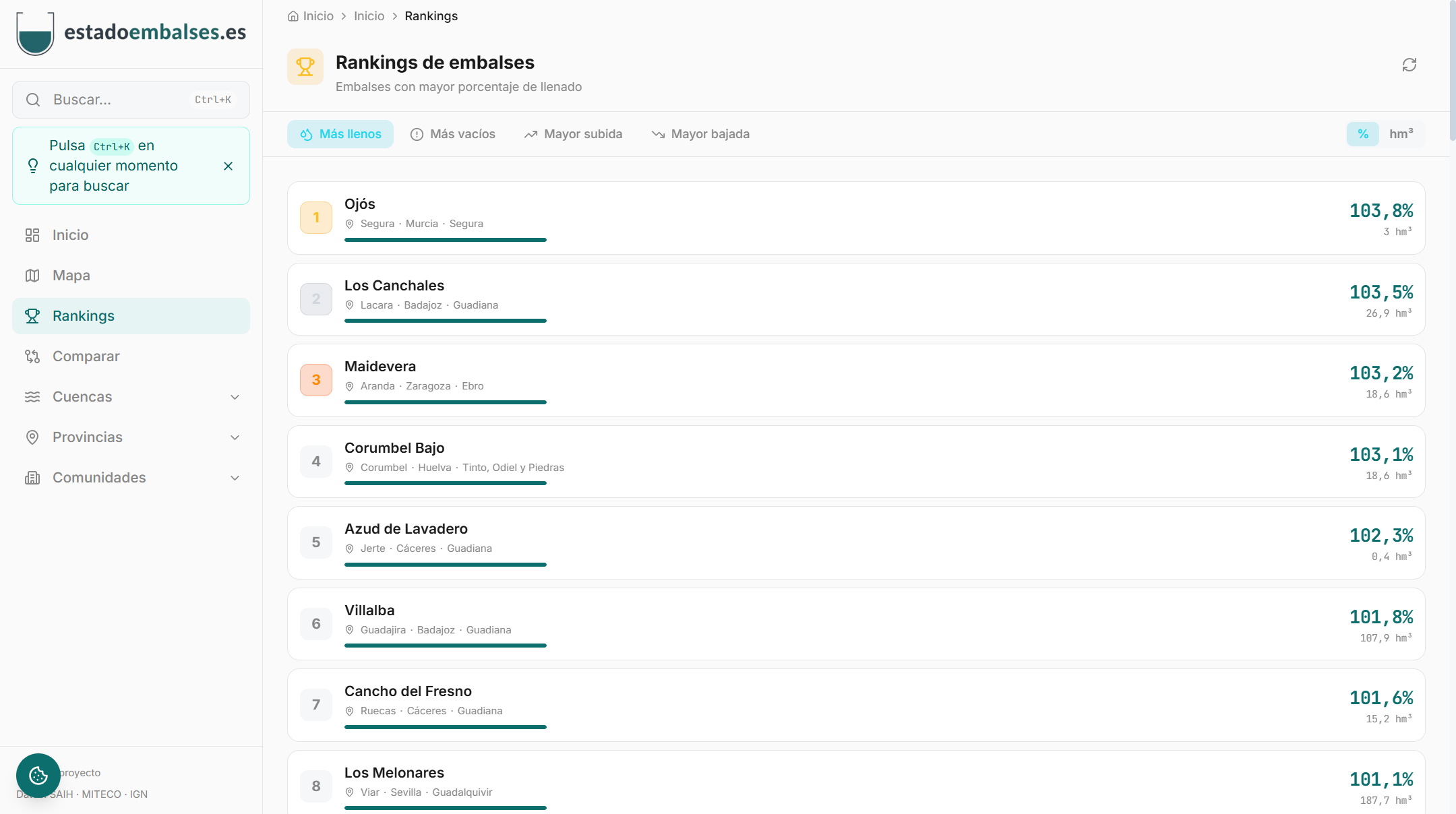
- Reservoir rankings: fuller, emptier, higher weekly rises and falls.
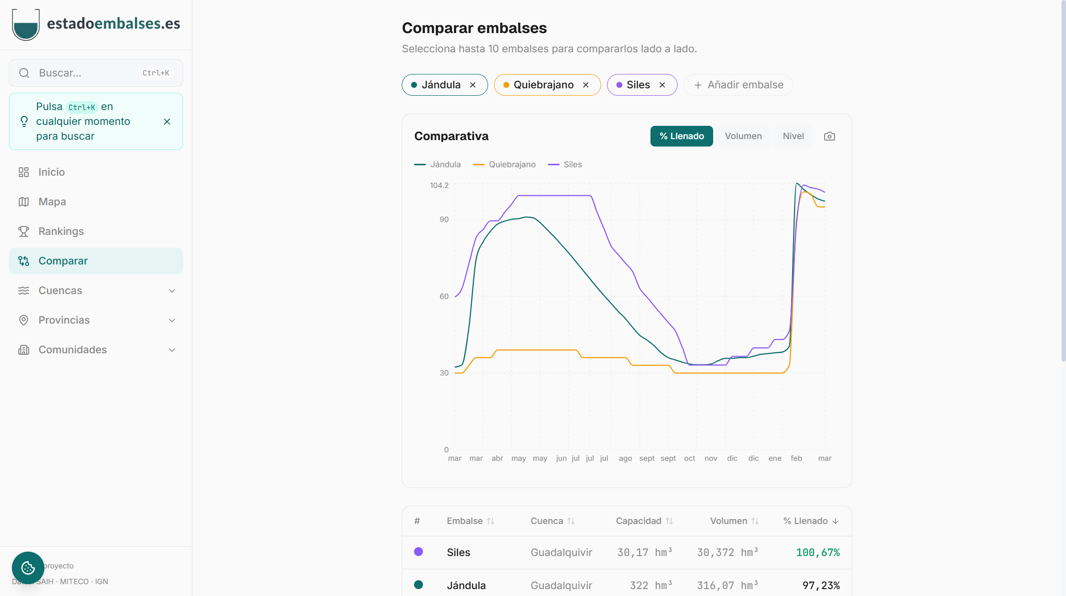
- Comparator of up to 10 reservoirs with simultaneous visualization of their data.
- Favorites system for quick access to selected reservoirs.
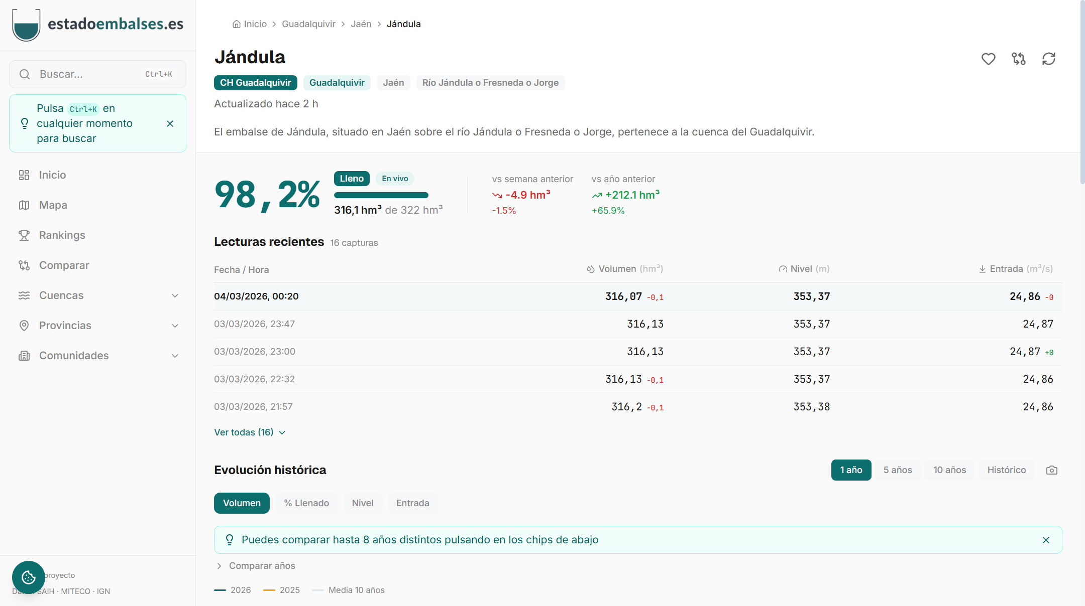
- Detailed technical data sheets with information on location, capacity and construction characteristics.
- Navigation through river basins, provinces, autonomous communities and rivers.
- Recent readings with hourly volume, level, and flow data.
- Download graphics in image format and generate infographics.
- Options to share data via WhatsApp, X (Twitter) or direct link.
- Global search engine for reservoirs, basins and provinces.
- Integration of graphics into other websites using iframe.
- Progressive web application (PWA) installable on mobile devices with offline access.
Data available by reservoir
- Reservoir volume (hm³)
- Water level (m)
- Fill Percentage (%)
- Inlet and outlet flow (m³/s)
- Accumulated precipitation (mm)
All data is displayed without alterations, respecting its original format.