Images
Information
Description
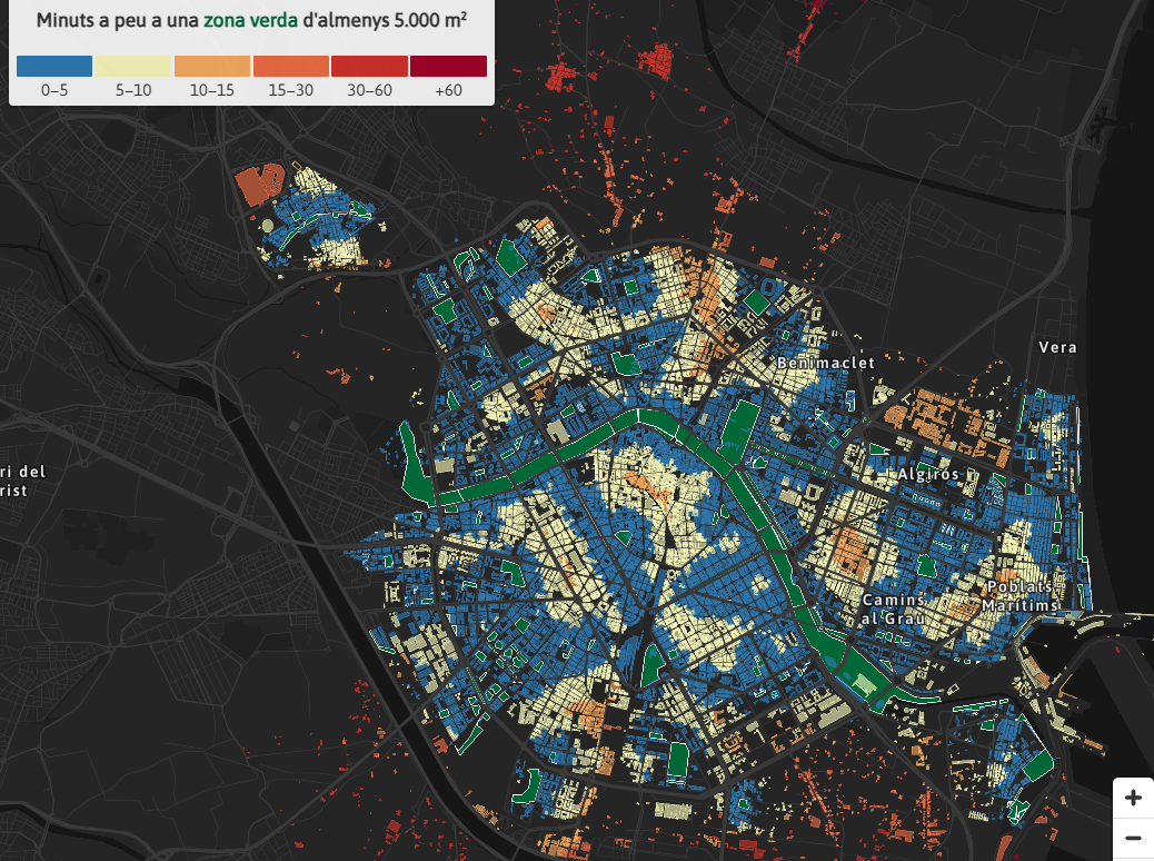
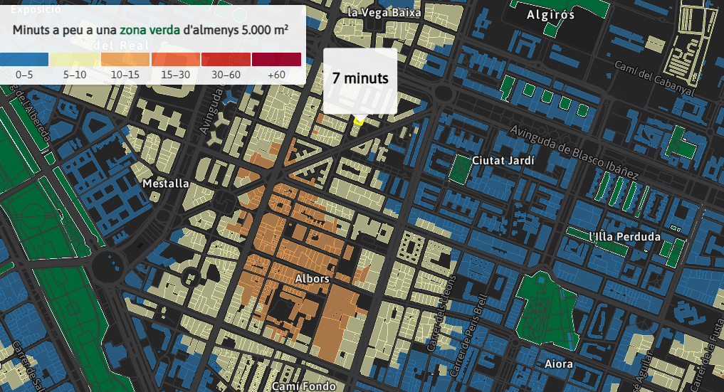
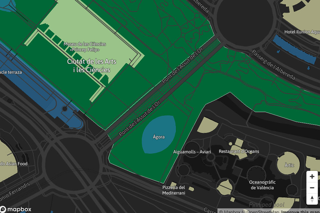
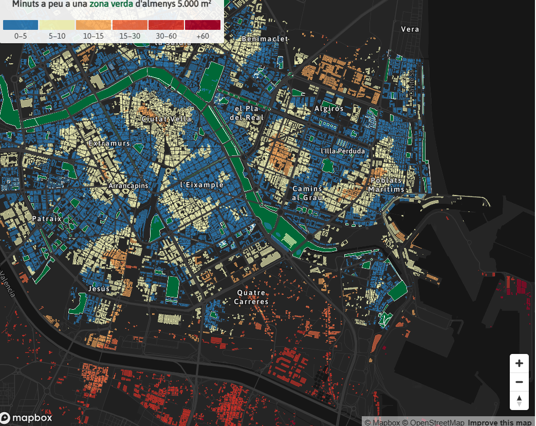
This journalistic piece published by À Punt includes a dynamic map elaborated with the geospatial open data offered by Open Street Map that represents the distance in approximate time in which each neighbourhood is located from a green space. In other words, the map shows the shortest walking distance from each building to a green area of at least 0.5 hectares.
Open data sets from Valencia City Council and the Cadastre have been used to create this open consultation map.