Images


Information
Description
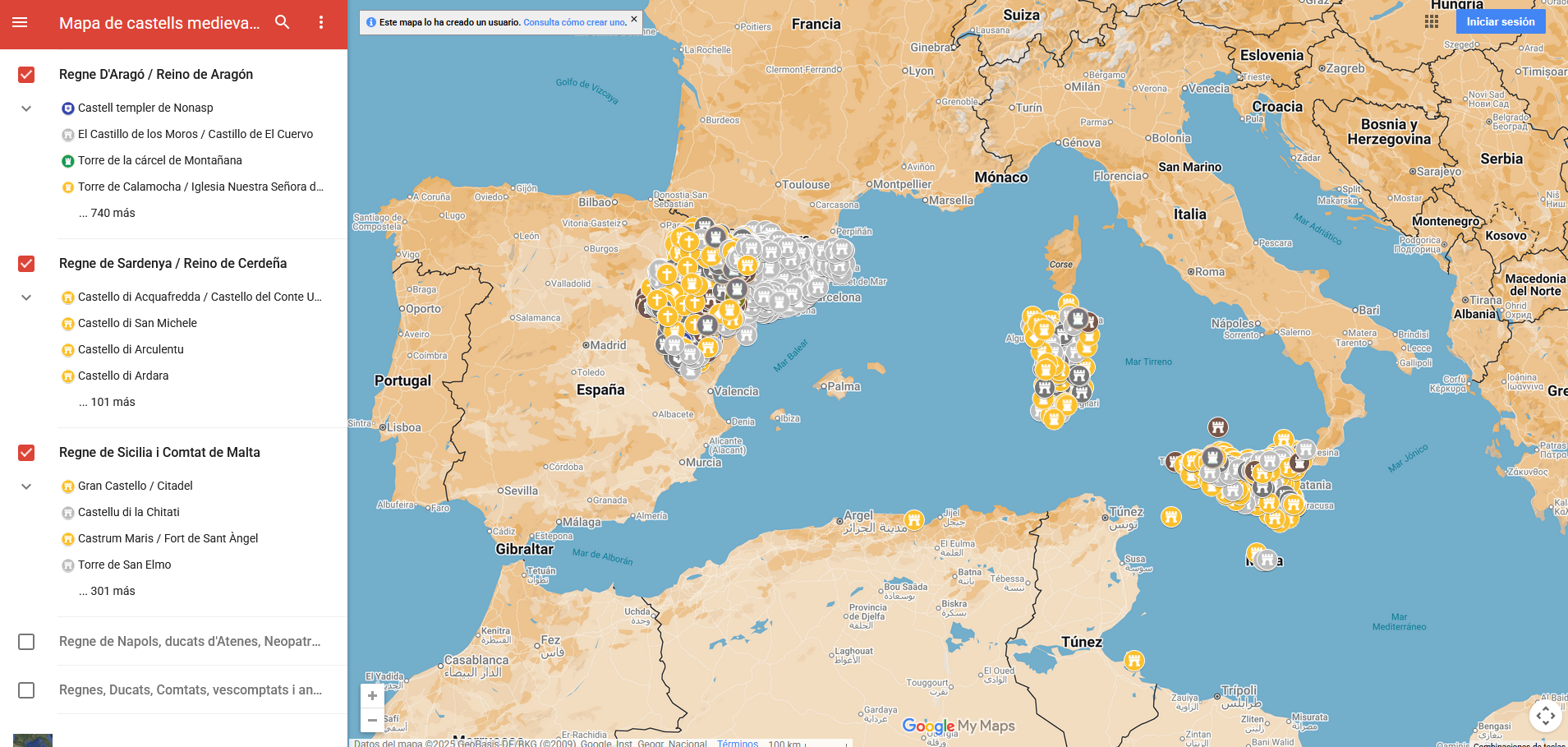
The map of medieval castles of the Crown of Aragon is an interactive map, made with Google My Maps, which offers a geographical representation of the castles, towers, fortifications and palaces from the Carolingian era to the end of the fifteenth century of the different kingdoms of the Crown of Aragon. The viewer allows you to explore the location of around 4,800 castles, including towers and other fortifications.
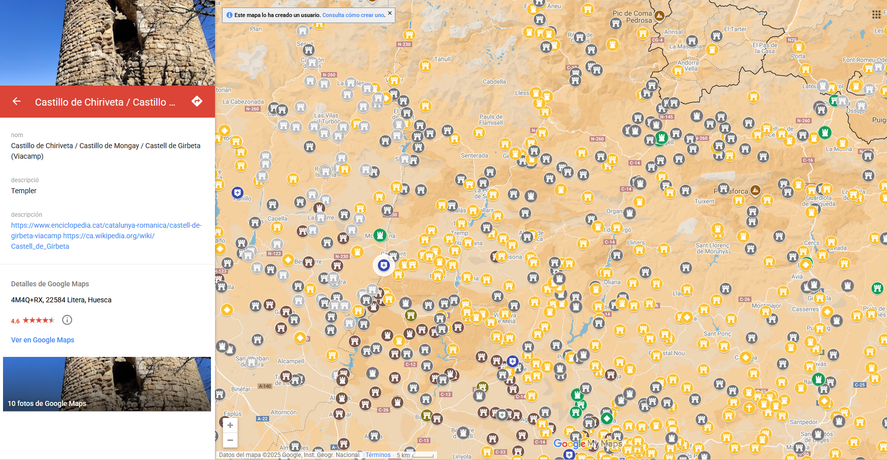
Each marker on the map points out the approximate location of a castle, and includes additional information such as the name, a brief description, as well as the images available on Google Maps. In some cases, an external link to more extensive information on the asset is also included.
It has a legend by colors:
- In grey: missing, remains or with modern constructions on top
- In green: visited by the author
- In brown: of Muslim origin
- In yellow: of Christian origin
- In blue: templar
The map allows you to filter the heritage of the following territories:
- Castles of the Principality of Catalonia
- Disappeared castles of Catalonia
- Castles of Northern Catalonia
- Kingdom of Mallorca
- Kingdom of Valencia
- Kingdom of Aragon
- Kingdom of Sardinia
- Kingdom of Sicily and County of Malta
- Kingdom of Naples, Duchies of Athens, Neopatria and others
- Kingdoms, Duchies, Counties, Viscounties and former Taifa capitals
This project won second prize at Insight Penedès 2024, an innovation competition for young people organised by the Pro-Penedès Foundation in collaboration with Vilafranca City Council and Barcelona Provincial Council.