
Images


Information
Description
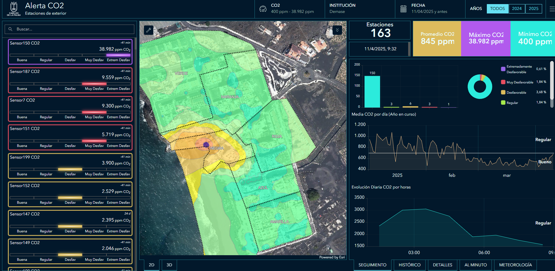
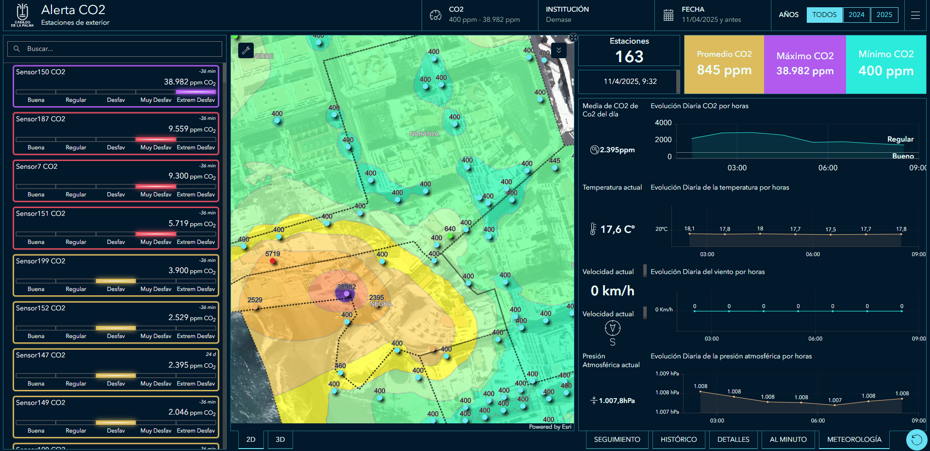
The app makes it possible to visualise CO₂ levels in real time and act in advance. To do so, they use Internet of Things (IoT) technology, artificial intelligence, Big Data, Geographic Information Systems (GIS), digital twin and open data. The platform processes data from LoRaWAN sensors, a high-precision IoT device that enables the collection and transmission of data over long distances while maintaining low energy consumption.
CO2 Alert issues immediate warnings, offers interactive maps and is available for citizens and emergency management. In addition, the website also provides a dashboard of the status of each Co2 percentage level on the map, the evolution of the historical Co2 analysis and downloadable data.