

Images
Information
Description
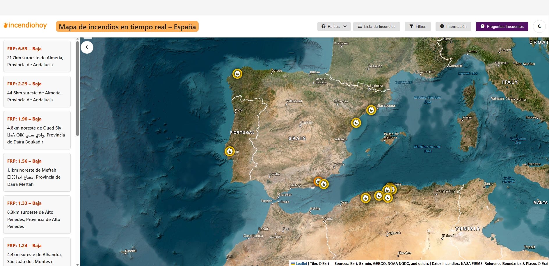
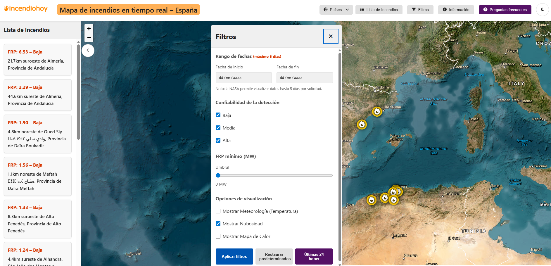
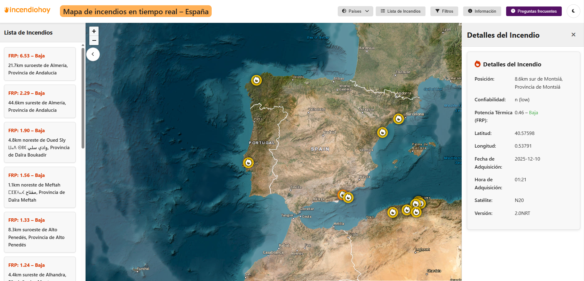
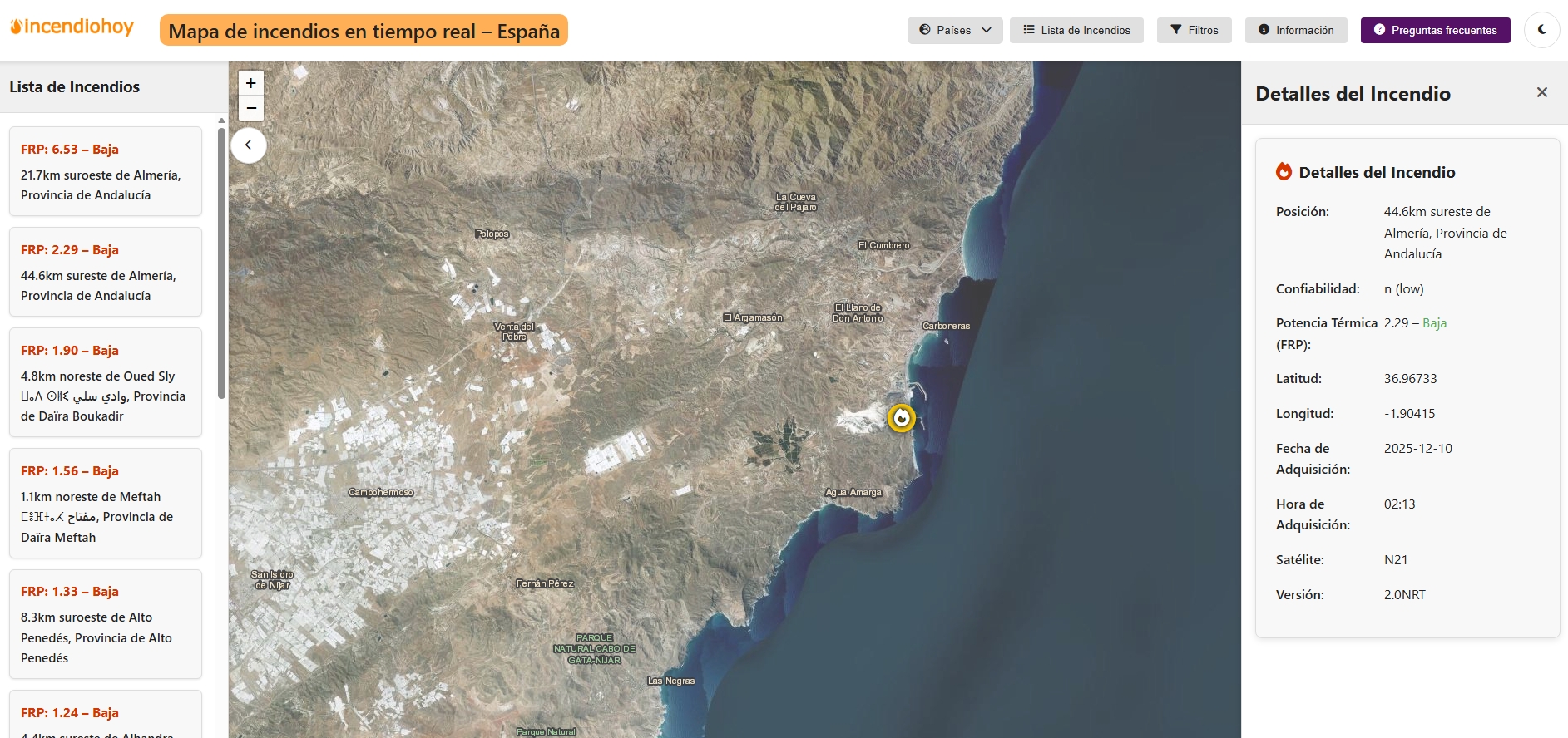
Incendio Hoy is a web viewer that shows in near real time the active fires in Spain based on open data from NASA FIRMS (VIIRS and MODIS sensors). The app automatically queries and updates the detections (hootspots) with a cadence of minutes and represents them on an interactive map of simple controls. The user can filter by time range (up to five days), reliability level (low/medium/high) and FRP (radiative fire power, in MW) to focus on the most relevant events. Clicking on a point displays a tab with coordinates, date/time, sensor, current (FRP), and other details. In addition, it includes optional temperature and cloud cover layers, and a heat map to identify clusters.
The website incorporates a "Frequently Asked Questions" section that explains key concepts, such as differences between VIIRS and MODIS, what FRP is, the level of reliability, why the fire may not appear or the limits of satellite detection.