
Images

Information
Description
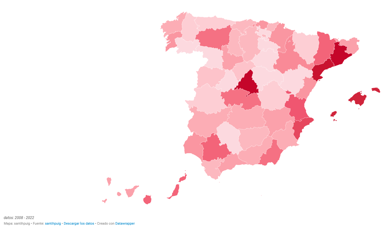
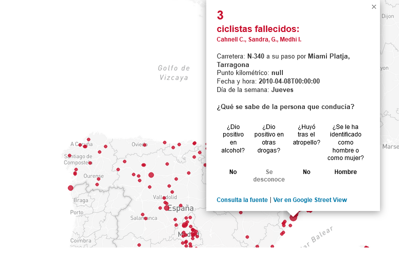
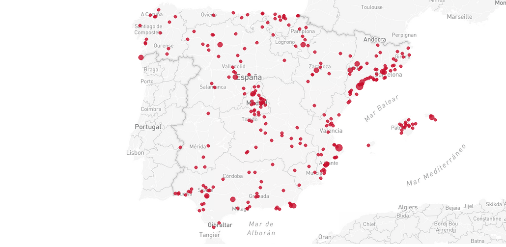
This application is a map in which about 70% of the fatal cyclist hit-and-runs on Spanish roads in the last fifteen years are geolocated. Each point on the map represents a fatal hit-and-run and contains the following information: cyclists killed, date and time, road, circumstances of the driver, link to Google Street View and to the source of information.
The dataset used is made up of accident data from the Dirección General de Tráfico and information obtained from the consultation of more than 300 news items on hit-and-runs in the digital version of different media.
From the data obtained, the application shows in which provinces there have been a greater number of accidents or in which time slot and day of the week they are more frequent.
The open data sources are:
-
DGT: https://www.dgt.es/menusecundario/dgt-en-cifras/dgt-en-cifras-resultado…
-
Information has also been extracted from more than 300 news items on road accidents.