
Images
Information
Description
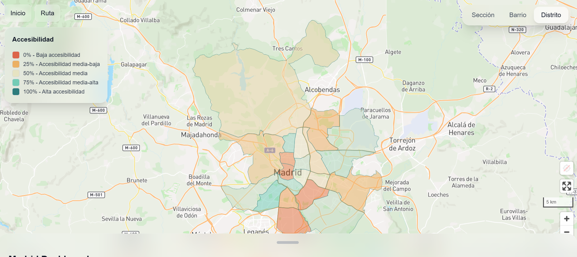
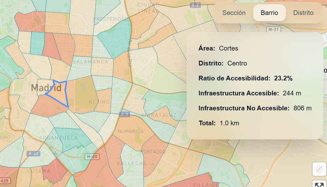
Rampa is a route service for people with reduced mobility. This project, developed as part of the Madrid City Council's 2025 Open Data Reuse Awards, combines open data and geospatial technology to facilitate the search for accessible routes and services for people with reduced mobility.
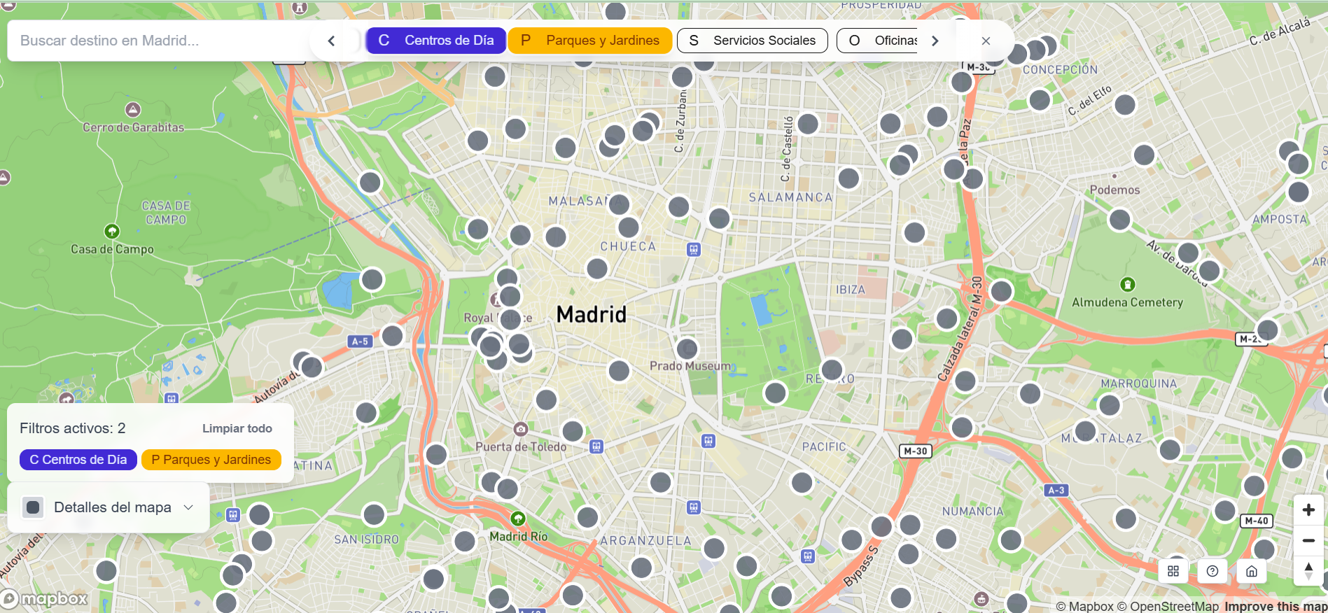
The web application provides the following data:
- Accessibility: it offers optimised routes for wheelchairs, walkers and people with reduced mobility.
- Demographic data: it allows you to view ageing, dependency and population density indices to better understand the needs of each area.
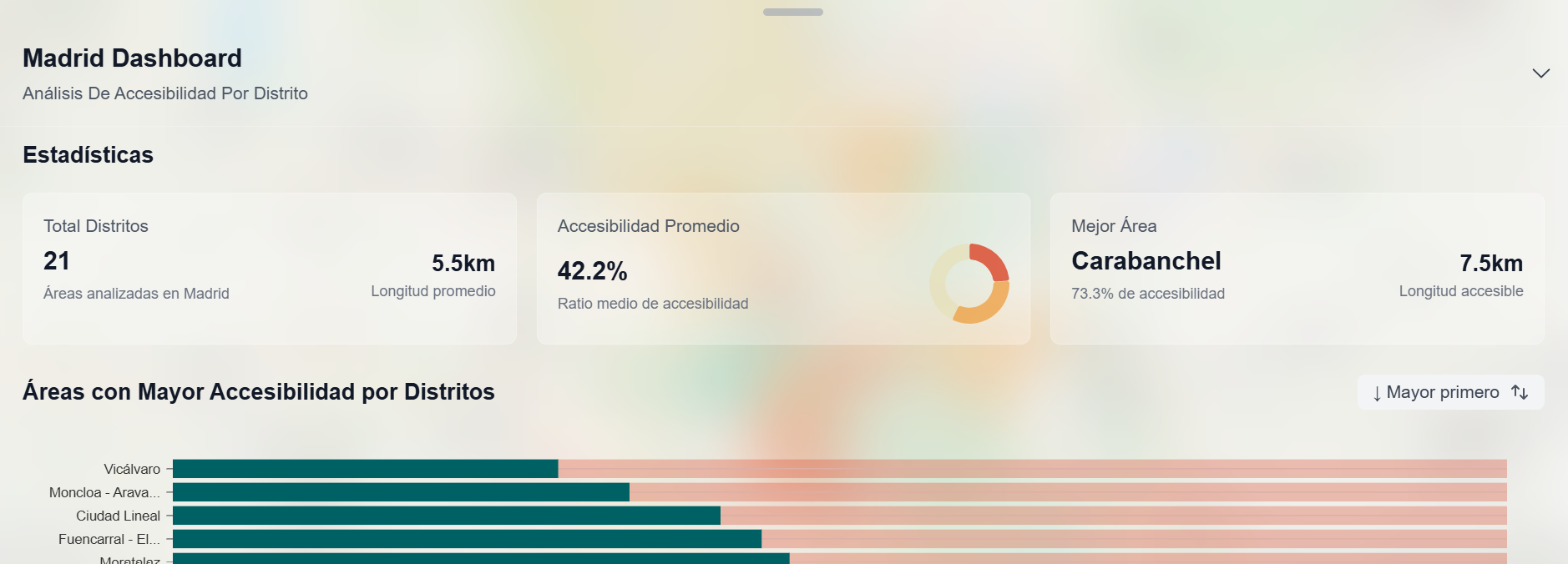
- Control panel: it allows you to view the areas with the highest and lowest accessibility in Madrid and detects the most accessible neighbourhoods and districts.
