
Images


Information
Description
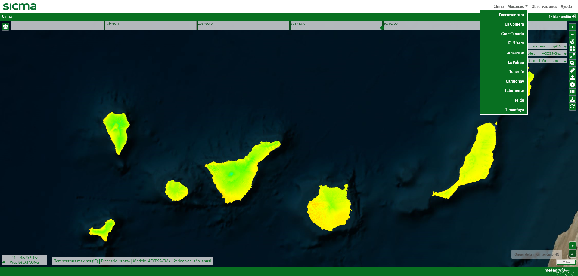
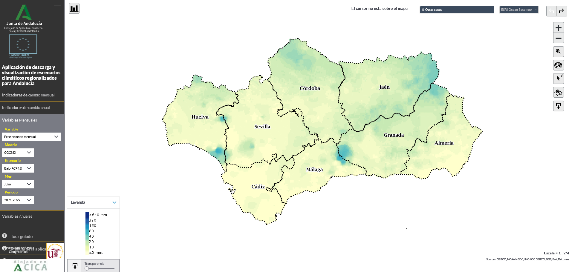
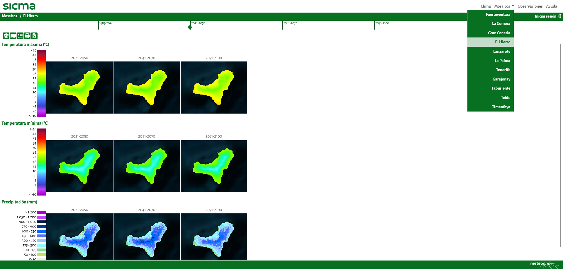
Sicma, a climate and environmental information system, is a platform that displays climate scenarios and various variables generated from them. This application is developed entirely with free software and allows users to consult current, past, and future climate conditions, with variable spatial resolution according to the needs of each case (100 by 100 meters in the case of the Canary Islands, and 200 by 200 meters in the case of Andalusia). This makes it possible to obtain local information on the point of intervention.
The information is generated for the scenarios, models, horizons and annual periods considered necessary in each case and with the most appropriate resolution and interpolations for each territory.
Sicma provides information on variables calculated from daily series. To quantify uncertainties, it offers projections generated from ten climate models based on the sixth report of the Intergovernmental Panel on Climate Change (IPCC), each under four future emissions scenarios, known as shared socio-economic pathways (SSPs). Therefore, a total of 40 projections are generated. These climate projections, detailed up to the year 2100, are a very useful tool for planning and managing water, agriculture and environmental conservation.
Users can easily access information on climate scenarios, providing representative data in different territorial areas through a viewer. Some of the variables included in this viewer are: maximum temperature, average temperature, minimum temperature, precipitation, potential evapotranspiration, water balance, hot days (>40ºC) or tropical nights (>22ºC).
In addition to viewing, it is also possible to download data in alphanumeric formats in spreadsheets, graphs, or value maps.
There are currently two open sicma environments:
- Sicma Andalucía: https://andalucia.sicma.red/
- Sicma Canarias: https://canarias.sicma.red/