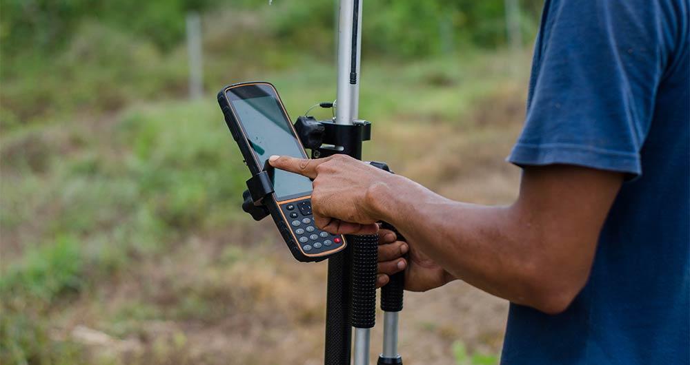
Description
On September 8, the webinar \"Geospatial Trends 2023: Opportunities for data.europa.eu\" was held, organized by the Data Europa Academy and focused on emerging trends in the geospatial field. Specifically, the online conference addressed the concept of GeoAI (Geospatial Artificial Intelligence), which involves the application of artificial intelligence (AI) combined with geospatial data.
Next, we will analyze the most cutting-edge technological developments of 2023 in this field, based on the knowledge provided by the experts participating in the aforementioned webinar.
What is GeoAI?
The term GeoAI, as defined by Kyoung-Sook Kim, co-chair of the GeoAI Working Group of the Open Geospatial Consortium (OGC), refers to \"a set of methods or automated entities that use geospatial data to perceive, construct (automate), and optimize spaces in which humans, as well as everything else, can safely and efficiently carry out their geographically referenced activities.\"
GeoAI allows us to create unprecedented opportunities, such as:
- Extracting geospatial data enriched with deep learning: Automating the extraction, classification, and detection of information from data such as images, videos, point clouds, and text.
- Conducting predictive analysis with machine learning: Facilitating the creation of more accurate prediction models, pattern detection, and automation of spatial algorithms.
- Improving the quality, uniformity, and accuracy of data: Streamlining manual data generation workflows through automation to enhance efficiency and reduce costs.
- Accelerating the time to gain situational knowledge: Assisting in responding more rapidly to environmental needs and making more proactive, data-driven decisions in real-time.
- Incorporating location intelligence into decision-making: Offering new possibilities in decision-making based on data from the current state of the area that needs governance or planning.
Although this technology gained prominence in 2023, it was already discussed in the 2022 geospatial trends report, where it was indicated that integrating artificial intelligence into spatial data represents a great opportunity in the world of open data and the geospatial sector.
Use Cases of GeoAI
During the Geospatial Trends 2023 conference, companies in the GIS sector, Con terra and 52ºNorth, shared practical examples highlighting the use of GeoAI in various geospatial applications.
Examples presented by Con terra included:
- KINoPro: A research project using GeoAI to predict the activity of the \"black arches\" moth and its impact on German forests.
- Anomaly detection in cell towers: Using a neural network to detect causes of anomalies in towers that can affect the location in emergency calls.
- Automated analysis of construction areas: Aiming to detect building areas for industrial zones using OpenData and satellite imagery.
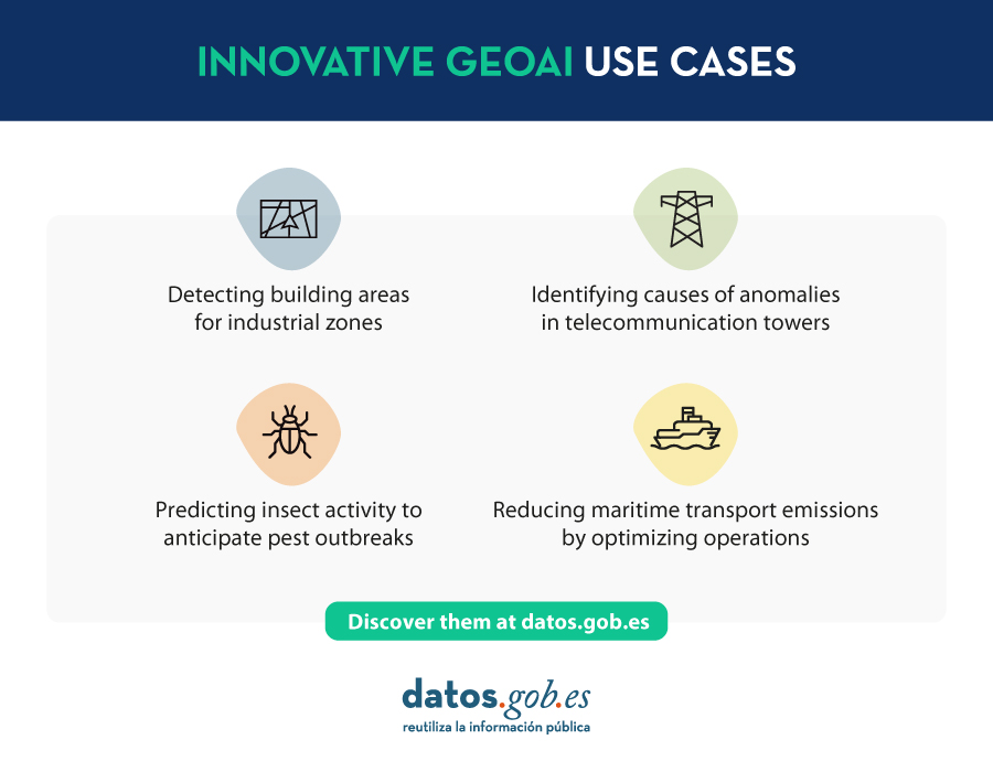
On the other hand, 52ºNorth presented use cases such as MariData, which seeks to reduce emissions from maritime transport by using GeoAI to calculate optimal routes, considering ship position, environmental data, and maritime traffic regulations. They also presented KI:STE, which applies artificial intelligence technologies in environmental sciences for various projects, including classifying Sentinel-2 images into (un)protected areas.
These projects highlight the importance of GeoAI in various applications, from predicting environmental events to optimizing maritime transport routes. They all emphasize that this technology is a crucial tool for addressing complex problems in the geospatial community.
GeoAI not only represents a significant opportunity for the spatial sector but also tests the importance of having open data that adheres to FAIR principles (Findable, Accessible, Interoperable, Reusable). These principles are essential for GeoAI projects as they ensure transparent, efficient, and ethical access to information. By adhering to FAIR principles, datasets become more accessible to researchers and developers, fostering collaboration and continuous improvement of models. Additionally, transparency and the ability to reuse open data contribute to building trust in results obtained through GeoAI projects.
Reference
| Reference video | https://www.youtube.com/watch?v=YYiMQOQpk8A |


Estas tendencias emergentes sobre los datos geoespaciales europeos en el 2023 es muy bueno
Estimada Laura.
Gracias por tus palabras, nos alegra saber que el contenido que publicamos en datos.gob.es resulta de interés.
Un saludo.