Application
Web platform for filtering and organizing proposals from the Congress of Deputies according to party votes, with the ability to show how one or more parties voted collectively or individually.
As proposals may have several votes, the main vote for each proposal is extracted using a ChatGPT AI model. AI is also used to extract information on the different points of a proposal and generate an explanatory description of the proposal that is understandable to anyone.
The aim is to have a platform where the activity of the Congress of Deputies can be seen clearly and simply.
Application
Open SDG Index is a platform for managing and visualising results and progress in the fulfilment of the Sustainable Development Goals and the 2030 Agenda. It allows reporting and systematizing the progress and effort made by public and private entities to meet the SDGs. On the one hand, it facilitates the self-evaluation of this progress and, on the other, it makes the results known to the general public. It is part of the SDG system and allows any entity to incorporate and update its profile.
The portal includes advanced searches, sectoral and territorial filters and organisation profiles for open consultation. The information is verified by independent agents and presented geolocalized to facilitate comparison between organizations and territories.
For the deployment of the Open SDG Index, a proprietary methodology has been developed in collaboration with the UNDP (United Nations Development Programme). The project won the First Prize for Social Entrepreneurship "La Noria" from the Diputación de Málaga in 2020.
Noticia
The reuse of open data makes it possible to generate innovative solutions that improve people's lives, boost citizen participation and strengthen public transparency. Proof of this are the competitions promoted this year by the Junta de Castilla y León and the Madrid City Council.
Being the IX edition of the Castilla y León Competition and the first edition of the Madrid Competition, both administrations have presented the prizes to the selected projects, recognising both students and startups as well as professionals and researchers who have been able to transform public data into useful tools and knowledge. In this post, we review the award-winning projects in each competition and the context that drives them.
Castilla y León: ninth edition of consolidated awards in a more open administration
At the awards ceremony of the IX Open Data Contest of the Junta de Castilla y León, the budget reinforcement (+65%) in the General Directorate of Transparency and Good Governance, the expansion of active advertising content and a continuous improvement of the right of access to public information, which has reduced requests and rejection resolutions, were highlighted. The Open Data Portal of Castilla y León has 776 datasets that allow the development of services, applications and studies each year.
The Open Data Awards recognize initiatives in four categories: Ideas, Products and Services, Teaching Resources, Data Journalism.
Ideas
-
First prize: CyL Rural Hub. Proposal to develop a comprehensive platform for the rural territory that centralises services, infrastructures, job opportunities and educational offer. Its objective is to provide families and professionals with useful information to plan a life project in the villages of the community.
-
Second prize: Cultural App of Castilla y León. An idea aimed at boosting cultural activity through an application that centralises events, activities and locations, also offering an intuitive and close experience based on open data.
Products & Services
-
First prize: CyL Bridge. Application designed to support the integration of migrants through personalized routes, an artificial intelligence assistant and a resource center powered by public data.
-
Second prize: MuniCyL. A tool that brings together dispersed municipal information and presents it on a single clear, accessible and up-to-date platform.
-
Third prize: Interactive map of Natural Spaces. A resource that allows citizens to explore the protected areas of the territory dynamically and in real time.
-
Student awards: Info Salamanca. Platform that offers interactive maps, thematic filters and a conversational assistant to bring provincial information closer and facilitate the consultation of citizen data.
Teaching Resource
-
First prize: Use of open data from the Junta de Castilla y León in web development. A project that introduces open data into the learning of web development, with practical exercises and an AI search engine to work directly with real data from the portal.
Data Journalism
-
First prize: Heart attacks are no longer a matter of age, a report on the increase in heart attacks among young people.
-
Second prize: Burgos maintains regional leadership with 79 wind farms: an analysis of the deployment of renewable energies in the region.
Madrid: first edition of awards that promote reuse in the urban environment
On the other hand, the Madrid City Council has held the first edition of the Open Data Reuse Awards 2025. The ceremony highlighted the quality and diversity of the 65 applications submitted, many of them driven by university students and startups.
The awards seek to promote the use of data from the Madrid City Council's Open Data Portal, support the creation of services and studies that contribute to knowledge of the city and reinforce the role of the city council as a benchmark administration in transparency and accountability.
In this case, the awards are structured into four categories: Web Services and Applications, Visualizations, Studies and Ideas, and Portal Improvement.
Web Services & Applications
-
First prize: Madriwa. Find your place in Madrid. A tool that facilitates the search for housing through data on neighbourhoods, services and prices, allowing an informed and simplified comparison.
-
Second prize: The guardians of the air. Application developed by Tangible Data to check the city's air quality, especially designed to raise awareness among young people and educational centers.
Data viz
-
First prize: Ramp. Routes for people with reduced mobility. It presents accessible itineraries based on geospatial and orography data, offering alternative routes adapted to people with reduced mobility.
-
Second prize: AccesibiliMad. It shows public services available in each urban environment, with special attention to the specific needs of different groups.
Studies, Research and Ideas
-
First prize: Fifteen-minute cities for children. Analysis of the availability of essential services for minors within a maximum radius of 15 minutes, providing an innovative vision of urban planning.
-
Second prize: The impact of tourism in urban areas. This study delves into the relationship between tourist housing, the commercial fabric and labour dynamics, using urban and socio-economic data.
Improving Portal Quality
-
First prize: Your Open Data. Improving harvesting in data.europa.eu. Proposal that improves the way data is provided, raising the quality of metadata and boosting European interoperability.
-
Second prize: Discovery, observability and intelligent governance of open data. Solution that introduces an automated layer of intelligence and control over the municipal catalog.
Both Castilla y León, with a consolidated track record, and the Madrid City Council, which inaugurates its own recognition, contribute decisively to strengthening the Spanish open data ecosystem. Its calls are an example of how collaboration between administrations, citizens, academia and the private sector can transform public data into knowledge, participation and innovation at the service of society as a whole.
Application
embalses.info is a web platform that provides up-to-date information on the status of Spain’s reservoirs and dams. The application offers real-time hydrological data with weekly updates, allowing citizens, researchers, and public managers to consult water levels, capacities, and historical trends for more than 400 reservoirs organized into 16 river basins.
The application includes an interactive dashboard showing the overall status of Spanish reservoirs, an interactive (coming soon) basin map with filling levels, and detailed pages for each reservoir with weekly trend charts, comparisons with previous years, and historical records dating back to the 1980s. It features a powerful search engine, data analysis with interactive charts, and a contact form for suggestions.
From a technical standpoint, the platform uses Next.js 14+ with TypeScript on the frontend, Prisma ORM for data access, and PostgreSQL/SQL Server as the database. It is SEO-optimized with a dynamic XML sitemap, optimized meta tags, structured data, and friendly URLs. The site is fully responsive, accessible, and includes automatic light/dark mode.
The public value of the application lies in providing transparency and accessible information on Spain’s water resources, enabling farmers, public administrations, researchers, and the media to make informed decisions based on reliable and up-to-date data.
Evento
Once again, the Junta de Castilla y León has launched its open data contest to reward the innovative use of public information.
In this post, we summarize the details to participate in the IX edition of this event, which is an opportunity for both professionals and students, creative people or multidisciplinary teams who wish to give visibility to their talent through the reuse of public data.
What does the competition consist of?
The aim of the competition is to recognize projects that use open datasets from the Junta de Castilla y León. These datasets can be combined, if the participants wish, with other public or private sources, at any level of administration.
Projects can be submitted in four categories:
- Ideas category: aimed at people or teams who want to submit a proposal to create a service, studio, application, website or any other type of development. The project does not need to be completed; the important thing is that the idea is original, viable and has a potential positive impact.
- Products and services category: designed for projects already developed and accessible to citizens, such as online services, mobile applications or websites. All developments must be available via a public URL. This category includes a specific award for students enrolled in official education during the 2024/2025 or 2025/2026 school years.
- Didactic resource category: aimed at educational projects that use open data as a support tool in the classroom. The aim is to promote innovative teaching through Creative Commons licensed resources, which can be shared and reused by teachers and students.
- Data journalism category: it will reward journalistic works published or updated in a relevant way, in written or audiovisual format, that make use of open data to inform, contextualize or analyze topics of interest to citizens. The journalistic pieces must have been published in a printed or digital media since September 24, 2024, the day following the end date of the deadline for submission of candidacies of the immediately preceding call for awards.
In all categories, it is essential that at least one dataset from the open data portal of the Junta de Castilla y León is used. This platform has hundreds of datasets on different sectors such as the environment, economy, society, public administration, culture, education, etc. that can be used as a basis to develop useful, informative and transformative ideas.
Who can participate?
The competition is open to any natural or legal person, who can be presented individually or in a group. In addition, you can submit more than one application even for different categories. Although the same project may not receive more than one award, this flexibility allows the same idea to be explored from different approaches: educational, journalistic, technical or conceptual.
What prizes are awarded?
The 2025 edition of the contest includes prizes with a financial endowment, accrediting diploma and institutional dissemination through the open data portal and other communication channels of the Board.
The distribution and amount of the prizes by category is:
- Ideas category
- First prize: €1,500
- Second prize: €500
- Category products & services
- First prize: €2,500
- Second prize: €1,500
- Third prize: €500
- Special Student Prize: €1,500
- Category teaching resource
- First prize: €1,500
- Data journalism category
- First prize: €1,500
- Second prize: €1,000
Under what criteria are the prizes awarded? The jury will assess the candidatures considering different evaluation criteria, as set out in the rules and the order of call, including their originality, social utility, technical quality, feasibility, impact, economic value and degree of innovation.
How to participate?
As in other editions, candidacies can be submitted in two ways:
- In person, at the General Registry of the Ministry of the Presidency, at the registry assistance offices of the Junta de Castilla y León or at the places established in article 16.4 of Law 39/2015.
- Electronics, through the electronic headquarters of the Junta de Castilla y León
Each application must include:
- Identification data of the author(s).
- Title of the project.
- Category or categories to which it is submitted.
- An explanatory report of the project, with a maximum length of 1,000 words, providing all the information that can be assessed by the jury according to the established scale.
- In the case of submitting an application to the Products and Services category, the URL to access the project will be specified
The deadline to submit proposals is September 22, 2025
With this contest, the Junta de Castilla y León reaffirms its commitment to the open data policy and the culture of reuse. The competition not only recognizes the creativity, innovation and usefulness of the projects presented, but also contributes to disseminating the transformative potential of open data in areas such as education, journalism, technology or social entrepreneurship.
In previous editions, solutions to improve mobility, interactive maps on forest fires, tools for the analysis of public expenditure or educational resources on the rural environment, among many other examples, have been awarded. You can read more about last year's winning proposals and others on our website. In addition, all these projects can be consulted in the history of winners available on the community's open data portal.
We encourage you to participate in the contest and get the most out of open data in Castilla y León!
Evento
Madrid City Council has launched an initiative to demonstrate the potential of open data: the first edition of the Open Data Reuse Awards 2025. With a total budget of 15,000 euros, this competition seeks to promote the reuse of the data shared by the council on its open data portal, demonstrating that they can be a driver of social innovation and citizen participation.
The challenge is clear: to turn data into useful, original and impactful ideas. If you think you can do it, below, we summarize the information you must consider to compete.
Who can participate?
The competition is open to practically everyone: from individuals to companies or groups of any kind. The only condition is to submit a project carried out between September 10, 2022 and September 9, 2025 and that uses at least one dataset from the Madrid City Council's open data portal as a base. Data from other public and private sources can also be used, as long as the Madrid City Council datasets are a key part of the project.
Of course, projects that have already been awarded, contracted or financed by the City Council itself are not accepted, nor are works submitted after the deadline or without the required documentation.
What projects can be submitted?
There are four main areas in which you can participate:
- Web services and applications: refers to projects that provide services, studios, web applications, or mobile apps.
- Studies, research and ideas: refers to projects of exploration, analysis or description of ideas aimed at the creation of services, studies, visualizations, web applications or mobile apps. Bachelor's and master's degree final university projects can also participate in this category.
- Proposals to improve the quality of the open data portal: includes projects, services, applications or initiatives that contribute to boosting the quality of the datasets published on the Madrid City Council's open data portal.
- Data visualizations: you can participate in this category with various content, such as maps, graphs, tables, 3D models, digital art, web applications and animations. Representations can be static, such as infographics, posters, or figures in publications, or dynamic, including videos, interactive dashboards, and stories.
What are the prizes?
For each category, two prizes for different economic endowments are awarded:
|
Category |
First prize |
Second prize |
|
Web services and applications |
3.000 € | 1.500 € |
| Proposals to improve the quality of the open data portal | 3.000 € | 1.500 € |
| Studies, research and ideas | 2.000 € | 1.000 € |
| Data visualizations | 2.000 € | 1.000 € |
Figure 1. Prize money for the first edition of the 2025 Open Data Reuse Awards. Source: Madrid City Council.
Beyond the economic prize, this call is a great opportunity to give visibility to ideas that take advantage of the transparency and potential of open data. In addition, if the proposal improves public services, solves a real problem or helps to better understand the city, it will have great value that goes far beyond recognition.
How are projects valued?
A jury will evaluate each project by assigning a maximum score of 50 points, which will take into account aspects such as originality, social benefit, technical quality, accessibility, ease of use, or even design, in the case of visualizations. If deemed necessary, the jury may request further information submitted to the participants.
The two projects with the highest score will win, although to be considered, the proposals must reach at least 25 points out of a possible 50. If none of them meets this requirement, the category will be declared void.
The jury will be made up of representatives from different areas of the City Council, with experience in innovation, transparency, technology and data. A representative of ASEDIE (Multisectoral Association of Information), the association that promotes the reuse and distribution of information in Spain, will also participate.
How do I participate?
The deadline to register is September 9, 2025 at 11:59 p.m. In the case of natural people, the application can be submitted:
- Online through the City Council's Electronic Office. This procedure requires identification and electronic signature.
- In person at municipal service offices.
In the case of legal people, they may only submit their candidacy electronically.
In any case, the official form must be completed and accompanied by a report explaining the project, its operation, its benefits, the use of the data, and if possible, including screenshots, links or prototypes.
You can see the complete rules here.
Evento
More than 90,000 people from all over the world participated in the latest edition of the Space App Challenge. This annual two-day event, organized by the US space agency, NASA, is an opportunity to innovate and learn about the advantages that open space data can offer.
This year the competition will be held on October 4 and 5. Through a hackathon, participants will engage first-hand with NASA's most relevant missions and research. It's an opportunity to learn how to launch and lead projects through hands-on use of NASA data in the real world. In addition, it is a free activity open to anyone (those under 18 years of age must be accompanied by a legal guardian).
In this post, we tell you some of the keys you need to know about this global benchmark event.
Where is it held?
Under the banner of the Space Apps Challenge, virtual and face-to-face events take place all over the world. Specifically, in Spain, meetings are held in several cities:
- Barcelona
- Where: in person, at 42 Barcelona (Carrer D'Albert Einstein 11).
- Madrid
- Where: face-to-face, at the School of Digital Competences – San Blas Digital (Calle Amposta, 34).
- Murcia
- Where: in person at UCAM HITECH (Av. Andrés Hernandez Ros, 1, Guadalupe).
- Malaga
- Where: Face-to-face, at a location to be determined (you can contact the event organizer through the link).
- Pamplona
- Where: face-to-face and virtual, in a location to be determined (you can contact the event organization through the link)
- San Vicente del Raspeig (Alicante)
- Where: in person, at the Alicante Science Park (University of Alicante, San Vicente del Raspeig).
- Seville
- Where: Face-to-face, at a location yet to be determined (you can contact the event organizer via the link).
- Valencia
- Where: in person, at the UPV Student House, Polytechnic University of Valencia (Camino de Vera, s/n Building 4K).
- Zaragoza
- Where: in person, at the Betancourt Building, Río Ebro Campus (EINA) Calle María de Luna, 1.
All of them will have a welcome ceremony on Friday, October 3 at 5:30 p.m . in which the details of the competition will be presented, the teams and the themes of each challenge will be organized.
To participate in any of the events, you can register individually and the organization will help you find a team. You can also register your team directly (of a maximum of 6 people).
If you can't find any in-person events near you, you can sign up for the universal event that will be online.
Are there any prizes?
Yes! Each event will award its own prizes. In addition, NASA recognizes, each year, ten global awards divided into different categories:
-
Best Use of Science Award: recognizes the project that makes the most valid and outstanding use of science and/or the scientific method.
-
Best Data Use Award: awarded to the project that makes spatial data more accessible or uses it in a unique way.
-
Best Use of Technology Award: distinguishes the project that represents the most innovative use of technology.
-
Galactic Impact Award: awarded to the project with the greatest potential to improve life on Earth or in the universe.
-
Best Mission Concept Award: recognizes the project with the most plausible concept and design.
-
Most Inspiring Award: It is awarded to the project that manages to move and inspire the public.
-
Best Narrative Award: Highlights the project that most creatively communicates the potential of open data through the art of storytelling.
-
Global Connection Award: awarded to the project that best connects people around the world through technology.
-
Art and Technology Award: recognizes the project that most effectively combines technical and creative skills.
- Local Impact Award: awarded to the project that demonstrates the greatest potential to generate impact at the local level.
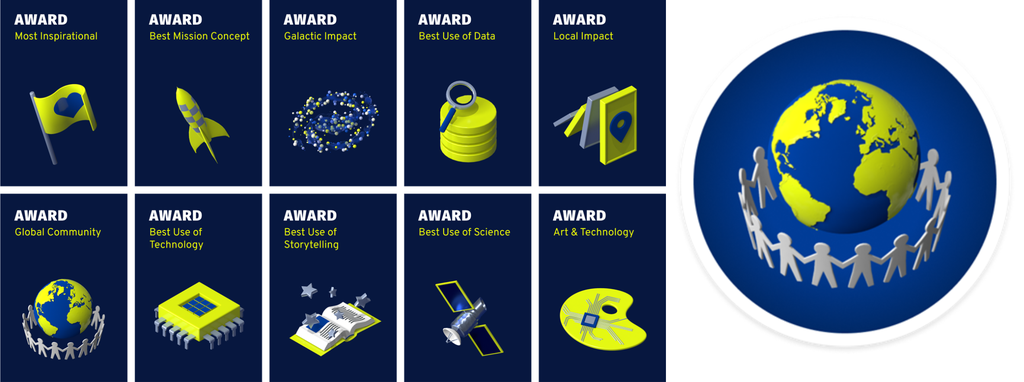
Figure 1. Space App Challenge Awards. Source: https://www.spaceappschallenge.org/brand/
From Gijón to the world: the Spanish project awarded in 2024
In last year's edition, a Spanish project, specifically from Gijón, won the global award for best mission concept with its Landsat Connect application proposal. The AsturExplorer team developed a web application designed to provide a fast, simple and intuitive way to track the path of Landsat satellites and access surface reflectance data. Their project fostered interdisciplinary and scientific learning capacities, and empowered citizens.
The Landsat program consists of a series of Earth observation satellite missions, jointly managed by NASA and the U.S. Geological Survey (USGS), providing images and data about our planet since 1972.
End users of the app developed by AsturExplorer can set a destination location and receive notifications in advance to know when the Landsat satellite will pass over each area. This allows users to prepare and take their own measurements on the ground and obtain pixel data without the need to constantly monitor satellite schedules.
The AsturExplorer team used open Landsat data from NASA and Earth Explorer. They also made use of artificial intelligence to understand the technical problem and compare multiple alternatives. You can read more about this use case here.
How do I register?
The Space App Challenge website offers a section of frequently asked questions and a video tutorial to facilitate registration. The process is simple:
- Create an account
- Register for the Hackathon
- Choose a local event
- Join a team and form your own
- Submit a project (before 11.59am on 5 October)
- Complete the Engagement Survey
We encourage you to be part of this global benchmark event where you will reuse open datasets. A great opportunity!
Application
Bizidata is a platform that visualises, analyses and allows you to download data on bicycle use in Vitoria-Gasteiz and explore how external factors, such as weather and traffic, influence bicycle use.
This application collects and combines the following data:
- Bicycle use: data from the Vitoria-Gasteiz City Council.
- Temperature between 2015 and 2021: Aemet data.
- Temperatures between 2022 and today: Euskalmet (station C040).
- Precipitation: Euskalmet (station C076).
- Traffic: Traffic Directorate of the Basque Government.
Bizidata was the winning application in the web services category of the Euskadi 2024 Open Data Competition.
Application
Tupreciodeluz.com offers daily information on the price of electricity, showing the cheapest price of the day, as well as the average price of the last 24 hours and the most expensive time slot. The aim is to allow consumers adhering to the regulated market tariff (PVPC) to modulate their consumption in order to save on their electricity bill.
The website also features an artificial intelligence assistant for energy advice, and measures to promote efficiency and responsible energy consumption.
In addition, consumers can use a solar sizer to find out the feasibility of installing solar energy in their home or business.
The website also has a blog where the most relevant news for consumers is published in a summarised and entertaining way.
Blog
Many people use apps to get around in their daily lives. Apps such as Google Maps, Moovit or CityMapper provide the fastest and most efficient route to a destination. However, what many users are unaware of is that behind these platforms lies a valuable source of information: open data. By reusing public datasets, such as those related to air quality, traffic or public transport, these applications can provide a better service.
In this post, we will explore how the reuse of open data by these platforms empowers a smarter and more sustainable urban ecosystem .
Google Maps: aggregates air quality information and transport data into GTFS.
More than a billion people use Google Maps every month around the world. The tech giant offers a free, up-to-date world map that draws its data from a variety of sources, some of them open.
One of the functions provided by the app is information about the air quality in the user's location. The Air Quality Index (AQI) is a parameter that is determined by each country or region. The European benchmark can be consulted on this map which shows air quality by geolocated zones in real time.
To display the air quality of the user's location, Google Maps applies a model based on a multi-layered approach known as the "fusion approach". This method combines data from several input sources and weights the layers with a sophisticated procedure. The input layers are:
- Government reference monitoring stations
- Commercial sensor networks
- Global and regional dispersion models
- Dust and smoke fire models
- Satellite information
- Traffic data
- Ancillary information such as surface area
- Meteorology
In the case of Spain, this information is obtained from open data sources such as the Ministry of Ecological Transition and Demographic Challenge, the Regional Ministry of Environment, Territory and Housing of the Xunta de Galicia or the Community of Madrid. Open data sources used in other countries around the worldcan be found here .
Another functionality offered by Google Maps to plan the best routes to reach a destination is the information on public transport. These data are provided on a voluntary basis by the public companies providing transport services in each city. In order to make this open data available to the user, it is first dumped into Google Transit and must comply with the open public transport standard GTFS (General Transit Feed Specification).
Moovit: reusing open data to deliver real-time information
Moovit is another urban mobility app most used by Spaniards, which uses open and collaborative data to make it easier for users to plan their journeys by public transport.
Since its launch in 2012, the free-to-download app offers real-time information on the different transport options, suggests the best routes to reach the indicated destination, guides users during their journey (how long they have to wait, how many stops are left, when they have to get off, etc.) and provides constant updates in the event of any alteration in the service.
Like other mobility apps , it is also available in offline mode and allows you to save routes and frequent lines in "Favourites". It is also an inclusive solution as it integrates VoiceOver (iOs) or TalkBack (Android) for blind people.
The platform not only leverages open data provided by governments and local authorities, but also collects information from its users, allowing it to offer a dynamic and constantly updated service.
CityMapper: born as a reuser of open mobility data
The CityMapper development team recognises that the application was born with an open DNA that still remains. They reuse open datasets from, for example, OpenStreetMap at global level or RENFE and Cercanías Bilbao at national level. As the application becomes available in more cities, the list of open data reference sources from which it draws information grows.
The platform offers real-time information on public transport routes, including bus, train, metro and bike sharing. It also adds options for walking, cycling and ridesharing. It is designed to provide the most efficient and fastest route to a destinationby integrating data from different modes of transport into a single interface.
As we published in the monographic report "Municipal Innovation through Open Data" CityMapper mainly uses open data from local transport authorities, typically using the GTFS (General Transit Feed Specification) standard . However, when this data is not sufficient or accurate enough, CityMapper combines it with datasets generated by the application's own users who voluntarily collaborate. It also uses data enhanced and managed by the work of the company's own local employees. All this data is combined with artificial intelligence algorithms developed to optimise routes and provide recommendations tailored to users' needs.
In conclusion, the use of open data in transport is driving a significant transformation in the mobility sector in cities. Through their contribution to applications, users can access up-to-date and accurate data, plan their journeys efficiently and make informed decisions. Governments, for their part, have taken on the role of facilitators by enabling the dissemination of data through open platforms, optimising resources and fostering collaboration across sectors. In addition, open data has created new opportunities for developers and the private sector, who have contributed with technological solutions such as Google Maps, Moovit or CityMapper. Ultimately, the potential of open data to transform the future of urban mobility is undeniable.