Noticia
Environmental sustainability and the fight against climate change are one of the greatest global challenges of our time. Addressing them requires solid evidence and reliable information to understand risks, track progress, guide decision-making, and assess impacts across sectors. As countries design and implement environmental, mitigation, and adaptation policies, access to climate data becomes an essential element for effective climate action.
In this context, open data plays a strategic role. Facilitating access to open and quality climate data allows public administrations, companies, scientific communities and civil society to plan and monitor sustainable territorial development, improve policy-making, foster collaboration between actors and transform scientific knowledge into concrete actions. Various initiatives are making it possible to make progress in improving the accessibility, interoperability and reuse of climate information, helping to overcome data dispersion and strengthen a coordinated response to climate change. Below, we compile a selection of international reference open data repositories and portals on climate.
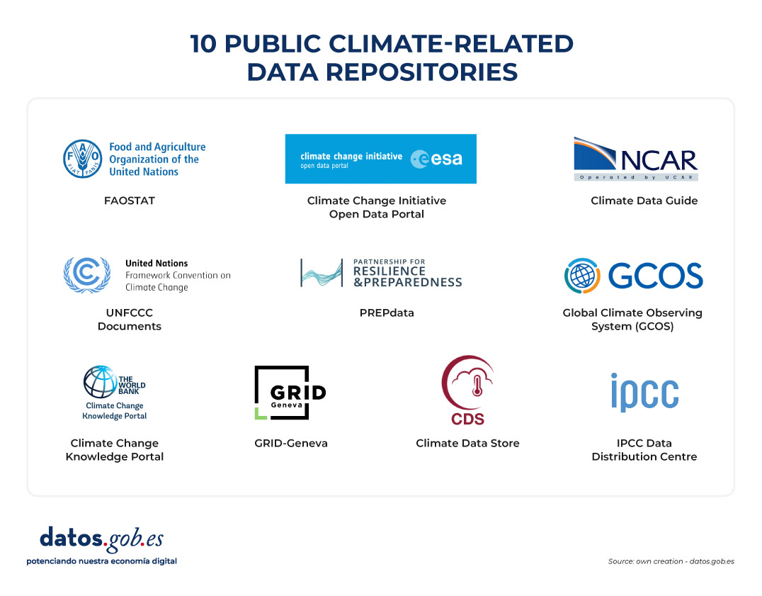
Figure 1. Ten public climate-related data repositories.
Climate Data Store
- Publisher: European Union Copernicus Programme
The Climate Data Store is the data portal of the Copernicus Climate Change Service (C3S). It offers open access to historical observations, reanalysis, climate indicators, and model-based future projections, with global and regional coverage. It includes variables such as temperatures, precipitation, wind, radiation, ice, and sea level. It provides integrated visualization, processing, and download tools for climate analysis, mitigation and adaptation policy planning.
Climate Change Knowledge Portal (CCKP)
- Publisher: World Bank
The World Bank's Climate Change Knowledge Portal provides historical climate data and future projections at global, national, and subnational scales. It includes temperature and precipitation variables, as well as geospatial layers and geocoded data on infrastructure and settlements. The CCKP facilitates climate vulnerability and risk analysis through interactive maps, country profiles, and the downloading of data in standard formats.
IPCC Data Distribution Centre
- Publisher: Intergovernmental Panel on Climate Change (IPCC) of the United Nations
The Intergovernmental Panel on Climate Change's Data Clearinghouse provides access to datasets used in IPCC assessment reports, including historical observations, climate projections, socio-economic scenarios, and key indicators. The portal brings together the data used in the Sixth Assessment Report (AR6), published between 2021 and 2023, although it continues to incorporate complementary and updated datasets that support the analysis of impacts, vulnerability and adaptation to climate change.
Climate Change Initiative Open Data Portal
- Publisher: European Space Agency (ESA)
Through its Climate Change Initiative (CCI) programme, the European Space Agency offers free and open access to datasets focused on Essential Climate Variables (LCDs), such as sea level, temperature, sea ice or land cover. The data, mainly from satellite observations, is available through downloads, interactive maps and web services, and is a key reference for climate monitoring.
Global Climate Observing System (GCOS)
- Publisher: World Meteorological Organization (WMO)
GCOS is an international system that coordinates and promotes climate observation networks to ensure the availability of high-quality data on the atmosphere, oceans and land surface. Developed in collaboration with the United Nations Environment Programme (UNEP), the Intergovernmental Oceanographic Commission of UNESCO (IOC-UNESCO) and the International Council for Science, GCOS facilitates access to climate observations through partner networks and systems.
GRID-Geneva
- Publisher: United Nations Environment Programme (UNEP)
UNEP/GRID-Geneva is a centre specializing in the analysis and visualization of environmental and climate data using geographic information systems, remote sensing and statistical analysis. It manages various specialized platforms, such as MapX, an open-source solution for managing and visualizing geospatial data on natural resources, a specific platform for data on climate change, or on early warning for the environment, among others.
UNFCCC Documents
- Publisher: United Nations Framework Convention on Climate Change (UNFCCC)
This portal brings together the documentary library of the United Nations Framework Convention on Climate Change. It allows you to search, filter and download multiple documents related to international climate negotiations, including decisions adopted at Conferences of the Parties (COPs), reports of subsidiary bodies, national communications and other texts relevant to the international climate process.
FAOSTAT
- Publisher: Food and Agriculture Organization of the United Nations (FAO)
FAOSTAT is the open-access statistical database of the Food and Agriculture Organization of the United Nations (FAO). It contains time series from 1961 to the present with coverage for more than 245 countries. It includes climate and agro-climatic data aimed at analysing the relationship between climate and food systems. Specifically, it offers indicators such as average temperatures, rainfall, evapotranspiration, climatic anomalies and variables related to droughts and water stress.
PREPdata
- Publisher: Partnership for Resilience and Preparedness (PREP)
PREPdata is a map-based open data platform that allows visualizing and combining climate, physical and socioeconomic information for vulnerability analysis and climate change adaptation planning. It is possible to create custom dashboards by integrating global data with local information provided by the users themselves. The initiative is led by the World Resources Institute (WRI) and Future Earth, together with public and private partners.
Climate Data Guide
- Publisher: National Center for Atmospheric Research (NCAR)
The Climate Data Guide offers expert descriptions, comparisons, and recommendations on climate datasets widely used in research. It organizes resources into seven categories: atmosphere, climate indices, cryosphere, land, ocean, paleoclimate, and reanalysis. This platform stands out for offering guidance and helping users understand what data exists, how it is generated, what limitations it has, and where to access it.
This is a compilation of open data repositories related to climate, but there are others that may be of interest. Which ones would you add to this list? Leave us a comment.
Application
The Smart Agro – Irrigation Recommendations website is a free platform developed by the Cabildo de La Palma as part of the La Palma Smart Island project. It aims to improve the efficiency of water use in local agriculture, especially for banana and avocado crops.
To get a personalized recommendation, the user must select a crop and an area of the island through a drop-down menu or on the map. Instead, the app:
- It provides detailed graphs showing the recent evolution of precipitation and evapotranspiration (ETo) over the past 7 days in the selected area.
- It generates irrigation recommendations adjusted to the municipality and local climatic conditions.
To carry out the calculations, data from the island's network of weather and air quality stations are used, together with a calculation engine that processes the information to generate weekly recommendations. Likewise, the data generated by this engine is integrated into the open data portal, promoting an open innovation ecosystem that feeds back on each other.
Application
CLIMA TERRA is a progressive web application (PWA) that provides real-time environmental information in a clear and accessible way. It allows users to view key parameters such as temperature, relative humidity, wind speed and UV index, based on open meteorological and geospatial data.
The app has been designed with a minimalist and bilingual (Spanish/English) approach, with the aim of bringing open data closer to the public and promoting more informed and sustainable everyday decisions.
Entrevista
In this episode we talk about the environment, focusing on the role that data plays in the ecological transition. Can open data help drive sustainability and protect the planet? We found out with our two guests:
- Francisco José Martínez García, conservation director of the natural parks of the south of Alicante.
- José Norberto Mazón, professor of computer languages and systems at the University of Alicante.
Listen to the full podcast (only available in Spanish)
Summary / Transcript of the interview
1. You are both passionate about the use of data for society, how did you discover the potential of open data for environmental management?
Francisco José Martínez: For my part, I can tell you that when I arrived at the public administration, at the Generalitat Valenciana, the Generalitat launched a viewer called Visor Gva, which is open, which gives a lot of information on images, metadata, data in various fields... And the truth is that it made it much easier for me - and continues to make it easier - for me to work on the resolution of files and the work of a civil servant. Later, another database was also incorporated, which is the Biodiversity Data Bank, which offers data in grids of one kilometer by one kilometer. And finally, already applied to the natural spaces and wetlands that I direct, water quality data, all of them are open and can be the object of generating applied research by all researchers.
Jose Norberto Mazón: In my case, it was precisely with Francisco as director. He directs three natural parks that are wetlands in the south of Alicante and about one of them, in which we had special interest, which is the Natural Park of Laguna de la Mata and Torrevieja, Francisco told us about his experience -all this experience that he has just commented on-. We at the University of Alicante have been working for some time on data management, open data, data interoperability, etc., and we saw the opportunity to make a perspective of data management, data generation and reuse of data from the territory, from the Natural Park itself. Together with other entities such as Proyecto Mastral, Faunatura, AGAMED, and also colleagues from the Polytechnic University of Valencia, we saw the possibility of studying these useful data, focusing above all on the concept of high-value data, which the European Union was betting on them: data that has the potential to generate socio-economic or environmental benefits, benefit all users and contribute to making a European society based on the data economy. And well, we set out there to see how we could collaborate, especially to discover the potential of data at the territory level.
2. Through a strategy called the Green Deal, the European Union aims to become the world's first competitive and resource-efficient economy, achieving net-zero greenhouse gas emissions by 2050. What concrete measures are most urgent to achieve this and how can data help to achieve these goals?
Francisco José Martínez: The European Union has several lines, several projects such as the LIFE project, focused on endangered species, the ERDF funds to restore habitats... Here in Laguna de la Mata and Torrevieja, we have improved terrestrial habitats with these ERDF funds and it is precisely about these habitats being better CO2 capturers and generating more native plant communities, eliminating invasive species. Then we also have the regulation, at the regulatory level, on nature restoration, which has been in force since 2024, and which requires us to restore up to 30% of degraded terrestrial and marine ecosystems. I must also say that the Biodiversity Foundation, under the Ministry, generates quite a few projects related, for example, to the generation of climate shelters in urban areas. In other words, there are a series of projects and a lot of funding in everything that has to do with renaturalization, habitat improvement and species conservation.
Jose Norberto Mazón: I would also focus, to complement what Francis has said, on all data management, the importance given to data management at the level of the European Green Deal, specifically with data sharing projects, to make data more interoperable. In other words, in the end, all those actors that generate data can be useful through their combination and generate much more value in what are called data spaces and especially in the data space of the European Green Deal. Recently, in addition, they have just finished some initial projects. For example, to highlight a couple of them, the USAGE project (Urban Data Spaces for Green dEal), which I am going to comment on with two specific pilots that they have developed very interestingly. One on how everything that has to do with data to mitigate climate change has to be introduced into urban management in the city of Ferrara, in Italy. And another pilot on data governance and how it has to be done to comply with the FAIR principles, in this case in Zaragoza, with a concept of climate islands that is also very interesting. And then there is another project, AD4GD (All Data for Green Deal) that has also carried out pilots in relation to this interoperability of data. In this case, in the Berlin Lake Network. Berlin has about 300 lakes that have to monitor the quality of the water, the quantity of water, etc. and it has been done through sensorization. The management of biological corridors in Catalonia, too, with data on how species move and how it is necessary to manage these biological corridors. And they have also done some air quality initiatives with citizen science. These projects have already been completed, but there is a super interesting project at the European level that is going to launch this large data space of the European Pact, which is the SAGE (Sustainable Green Europe Data Space) project, which is developing ten use cases that encompass this entire great area of the European Green Deal. Specifically, to highlight one that is very pertinent, because it is aligned with what are the natural parks, the wetlands of the south of Alicante and that Francisco directs, is that of the commitments between nature and ecosystem services. That is, how nature must be protected, how we have to conserve, but we also have to allow these socio-economic activities in a sustainable way. This data space will integrate remote sensing, models based on artificial intelligence, data, etc.
3. Would you like to add any other projects at this local or regional level?
Francisco José Martínez: Yes, of course. Well, the one we have done with Norberto, his team and several teams, several departments of the Polytechnic University of Valencia and the University of Alicante, and it is the digital twin. Research has been carried out for the generation of a digital twin in the Natural Park of Las Lagunas, here in Torrevieja. And the truth is that it has been an applied research, a lot of data has been generated from sensors, also from direct observations or from image and sound recorders. A good record of information has been made at the level of noise, climate, meteorological data to be able to carry out good management and that it is an invaluable help for the management of those of us who have to make decisions day by day. Other data that have also been carried out in this project here has been the collection of data of a social nature, tourist use, people's feelings (whether they agree with what they see in the natural space or not). In other words, we have improved our knowledge of this natural space thanks to this digital twin and that is information that neither our viewer nor the Biodiversity Data Bank can provide us.
Jose Norberto Mazón: Francisco was talking, for example, about the knowledge of people, about the influx of people from certain areas of the natural park. And also to know what they feel, what the people who visit it think, because if it is not through surveys that are very cumbersome, etcetera is complicated. We have put at the service of discovering that knowledge, this digital twin with a multitude of that sensorization and with data that in the end are also interoperable and that allow us to know the territory very well. Obviously, the fact that it is territorial does not mean that it is not scalable. What we are doing with the digital twin project, the ChanTwin project, what we are doing is that it can be dumped or extrapolated to any other natural area, because the problems that we have had in the end we are going to find in any natural area, such as connectivity problems, interoperability problems of data that come from sensors, etc. We have sensors of many types, influx of people, water quality, temperatures and climatic variables, pollution, etc. and in the end also with all the guarantees of data privacy. I have to say this, which is very important because we always try to ensure that this data collection, of course, guarantees people's privacy. We can know the concerns of the people who visit the park and also, for example, the origin of those people. And this is very interesting information at the level of park management, because in this way, for example, Francisco can make more informed decisions to better manage the park. But, the people who visit the park come from a specific municipality, with a city council that, for example, has a Department of the Environment or has a Department of Tourism. And this information can be very interesting to highlight certain aspects, for example, environmental, biodiversity, or socio-economic activity.
Francisco José Martínez: Data are fundamental in the management of the natural environment of a wetland, a mountain, a forest, a pasture... in general of all natural spaces. Note that only with the follow-up and monitoring of certain environmental parameters do we serve to explain events that can happen, for example, a fish mortality. Without having had the history of the dissolved oxygen temperature data, it is very difficult to know if it is because of that or because of a pollutant. For example, the temperature of water, which is related to dissolved oxygen: the higher the temperature, the less dissolved oxygen. And without oxygen, it turns out that they appear in spring and summer – okay, whatever the ambient temperatures are, it moves to the water, to the lagoons, to the wetlands – a disease appears that is botulism and there have already been two years that more than a thousand animals have died every year. The way to control it is by anticipating that these temperatures are going to reach a specific one, that from there the oxygen almost disappears from the waters and gives us time to plan the work teams that are removing the corpses, which is the fundamental action to avoid it. Another, for example, is the monthly census of waterfowl, which are observed in person, which are recorded, which we also have recorders that record sounds. With that we can know the dynamics when species come in migration and with that we can also manage water. Another example can be that of the temperature of the lagoon here in La Mata, which we are monitoring with the digital twin, because we know that when it reaches almost thirty degrees, the main food of the birds disappears, which is brine shrimp, because they cannot live in those extreme temperatures with that salinity. but we can bring in sea water, which despite the fact that it has been very hot these last springs and summers, is always cooler and we can refresh and extend the life of this species that is precisely synchronized with the reproduction of birds. So we can manage the water thanks to the monitoring and thanks to the data we have on the temperatures of the waters.
Jose Norberto Mazón: Look at the importance of these examples that Francisco mentioned, which are paradigmatic, and also the importance of the use of data. I would simply add a question that in the end these data, the effort is to make them all open and that they comply with those FAIR principles, that is, that they are interoperable, because as we have heard Francis have commented, they are data from many sources, each with different characteristics, collected in different ways, etc. You're talking to us about sensor data, but also other data that is collected in another way. And then also that they allow us in some way to start co-creation processes of tools that use this data at various levels. Of course, at the level of management of the natural park itself to make informed decisions, but also at the level of citizenship, even at the level of other types of professionals. As Francisco said, in the parks, in these wetlands, economic activities are carried out and therefore also being able to co-create tools with these actors or with the university research staff themselves is very interesting. And here it is always a matter of encouraging third parties, both natural and legal, for example, companies or startups, entrepreneurs, etc. that they make various applications and value-added services with that data: that they design easy-to-use tools for decision-making, for example, or any other type of tool. This would be very interesting, because it would also give us an entrepreneurial ecosystem around that data. And what this would also do is make society itself more involved from this open data, from the reuse of open data, in environmental care and environmental awareness.
4. An important aspect of this transition is that it must be "fair and leave no one behind". What role can data play in ensuring that equity?
Francisco José Martínez: In our case, we have been carrying out citizen science actions with the Environmental Education and Dissemination technicians. We are collecting data with people who sign up for these activities. We do two activities a month and, for example, we have carried out censuses of bats of different species - because one sees bats and does not distinguish the species, sometimes not even seeing them - on night routes, to detect and record them. We have also done photo trapping activities to detect mammals that are very difficult to see. With this we get children, families, people in general to know a fauna that they do not know exists when they are walking in the mountains. And I believe that we reach a lot of people and that we are disseminating it to as many people, as many sectors as possible.
Jose Norberto Mazón: And from that data, in fact, look at all the amount of data that Francis is talking about. From there, and promoting that line that Francisco follows as director of the Natural Parks of the south of Alicante, what we ask ourselves is: can we go one step further using technology? And we have made video games that make it possible to have more awareness among those target groups that may otherwise be very difficult to reach. For example, teenagers, who must be instilled in some way that behavior, that importance of natural parks as well. And we think that video games can be a very interesting channel. And how have we done it? Basing these video games on data, on data that come from what Francisco has commented on and also from the data of the digital twin itself. That is, data we have on the water surface, noise levels... We include all this data in video games. They are dynamic video games that allow us to have a better awareness of what the natural park is and of the environmental values and conservation of biodiversity.
5. You've been talking to us for a while about all the data you use, which in the end comes from various sources. Can we summarize the type of data you use in your day-to-day life and what are the challenges you encounter when integrating it into specific projects?
Francisco José Martínez: The data are spatial, they are images with their metadata, censuses of birds, mammals, the different taxonomic groups, fauna, flora... We also carry out inventories of protected flora in danger of extinction. Fundamental meteorological data that, by the way, are also very important when it comes to the issue of civil protection. Look at all the disasters that there are with cold drops or cut-off lows. Very important data such as water quality, physical and chemical data, height of the water sheet that helps us to know evaporation, evaporation curves and thus manage water inputs and of course, social data for public use. Because public use is very important in natural spaces. It is a way of opening up to citizens, to people so that they can know their natural resources and know them, value them and thus protect them. As for the difficulty, it is true that there is a series of data, especially when research is carried out, which we cannot access. They are in repositories for technicians who are in the administration or even for consultants who are difficult to access. I think Norberto can explain this better: how this could be integrated into platforms, by sectors, by groups...
Jose Norberto Mazón: In fact, it is a core issue for us. In the end there is a lot of open data, as Francis has explained throughout this little time that we have been talking, but it is true that they are very dispersed because they are also generated to meet various objectives. In the end, the main objective of open data is that it is reused, that is, that it is used for purposes other than those for which it was initially granted. But what we find is that in the end there are many proposals that are, as we would say, top-down (very top down). But really, where the problem lies is in the territory, from below, in all the actors involved in the territory, which apart from a lot of data is generated in the territory itself. In other words, it is true that there is data, for example, satellite data with remote sensing, which is generated by the satellites themselves and then reused by us, but then the data that comes from sensors or the data that comes from citizen science, etc., are generated in the territory itself. And we find that many times, in the end of that data, for example, if there are researchers who do a job in a specific natural park, then obviously that research team publishes its articles and data in open (because by the law of science they have to publish them in open in repositories). But of course, that is very research-oriented. So, the other types of actors, for example, the management of the park, the managers of a local entity or even the citizens themselves, are perhaps not aware that this data is available and do not even have mechanisms to consult it and obtain value from it. The greatest difficulty, in fact, is this, in that the data generated from the territory is reused from the territory. It is very easy to reuse them from the territory to solve these problems as well. And that difficulty is what we are trying to tackle with these projects that we have underway, at the moment with the creation of a data lake, a data architecture that allows us to manage all that heterogeneity of the data and do it from the territory. But of course, here what we really have to do is try to do it in a federated way, with that philosophy of open data at the federated level and also with a plus as well, because it is true that the casuistry within the territory is very large. There are a multitude of actors, because we are talking about open data, but there may also be actors who say "I want to share certain data, but not certain other data yet, because I may lose a certain competitiveness, but I would not mind being able to share it in three months' time". In other words, it is also necessary to have control over a certain type of data and that open data coexists with another type of data that can be shared. Maybe not so broadly, but in a way, let's say, providing great value. We are looking at this possibility with a new project that we are creating: a space for environmental data, biodiversity in these three natural parks in the south of the province of Alicante, and we are working on that project: Heleade.
If you want to know more about these projects, we invite you to visit their websites:
Interview clips
1. How was the digital twin of the Lagunas de Torrevieja Natural Park conceived?
2. What projects are being promoted within the framework of the European Green Deal Data Space?
Blog
The European Commission Implementing Regulation (EU) 2023/138 sets clear guidelines for public bodies on the availability of high-value datasets within 16 months from 20 January 2023. These high-value high value datasets (High value datasets or HVD) are grouped into the following themes, which were already described in this post: geospatial Earth observation and environment, Meteorology, Statistics, Societies and corporate ownership, and Mobility.
This article focuses on the category of Earth observation and environment, referred to as High Value Datasets for Earth Observation and Environment (HVDOM ).
Earth observation and environmental data in the regulation of high-value arrays
The HVDOM include data obtained in the following areas:
- Spatial or remotely sensed data.
- Ground or in situ data.
In particular, public bodies are faced with the obligation to make available to citizens high-value datasets that appear in various pieces of legislation:
- The environmental and climate datasets listed in the annexes of the Directive 2007/2/EC of the European Parliament and of the Council of 14 March 2007 establishing an Infrastructure for Spatial Information in Europe ( INSPIRE) indicated in the following visual:
| Inspire theme | Appendix |
|---|---|
| Hydrography | I |
| Protected sites | I |
| Elevations | II |
| Geology | II |
| Land cover | II |
| Orthoimaging | II |
| Areas to management, restrictions or regulations and reporting units | III |
| Biogeographical regions | III |
| Energy resources | III |
| Environmental observation facilities | III |
| Habitats and biotopes | III |
| Land use | III |
| Mineral resources | III |
| Natural hazard zones | III |
| Oceanographic geographical features | III |
| Production and industrial facilities | III |
| Marine regions | III |
| Soils | III |
| Species distribution | III |
2. Data sets produced in the context of legal acts and known as priority data, defined in the table below:
| Ámbito Medioambiental | Actos jurídicos que establecen las principales variables | |
|---|---|---|
| Air | Directive 2008/50/CE | Air Quality Directive |
| Directive 2004/107/CE | It adresses arsenic, cadmium, mercury, nickel and polycyclic aromatic hydrocarbons in ambient air. | |
| Climate | Regulation (UE) 2018/1999 | Governance of the Energy Union and Climate Action. |
| Regulation (CE) 1005/2009 | Substances that deplete the ozone layer. | |
| Emissions | Directive 2010/75/UE | Industrial Emissions Directive. |
| Directive 2012/18/UE | SEVESO III Directive. | |
| Directive 91/676/CEE | Nitrates Directive. | |
| Regulation (CE) 166/2006 | European Pollutant Release and Transfer Register. | |
| Regulation (UE) 2017/852 | Mercury Regulation. | |
| Directive (EU) 2016/2284 | Reduction of national emissions of certain atmospheric pollutants. | |
| Nature protection and biodiversity | Directive 2009/147/CE | Birds directive |
| Directive 92/43/CEE | Habitats Directive | |
| Regulation (UE) 1143/2014 | Invasive Alien Species Directive | |
| Data for the inventory of nationally designated protected areas (NDAAs), national biogeographic regions | EEA Annual Work Programme - Nationally Designated Areas - CDDA National legislation - National biogeographic regions | |
| Noise | Directive 2002/49/CE | Noise Directive |
| Waste | Directive 1999/31/CE | Landfill Directive |
| Directive 2006/21/CE | Directive on extractive waste | |
| Directive 86/278/CEE | Sewage Sludge Directive | |
| Directive 91/271/CEE | Urban Waste Water Treatment Directive | |
| Regulation (UE) 2019/1021 | Persistent Organic Pollutants (POPs) Regulation | |
| Recommendation 2014/70/UE | Recommendation on hydraulic fracturing | |
| Water | Directive 91/271/CEE | Urban Waste Water Treatment Directive |
| Directive 98/83/CE | Drinking Water Directive | |
| Directive 2006/7/CE | Bathing Water Directive | |
| Directive 2000/60/CE | Water Framework Directive | |
| Directive 2006/118/CE | Groundwater Directive | |
| Directive 2008/105/CE | Environmental Quality Standards Directive | |
| Directive 2020/2184/UE | Drinking Water Directive | |
| Directive 2007/60/CE | Floods Directive | |
| Directive 2008/56/CE | Marine Strategy Framework Directive | |
| Horizontal legislation | Directive 2004/35/CE | Prevention and remediation of environmental damage |
| Regulation (UE) 2020/852 | EU Taxonomy | |
At this URL of the INSPIRE register, the list of datasets related to environmental reporting, to be made available by Member States in a step-by-step manner, is published.
To ensure the accessibility and re-use of all these valuable datasets, it is imperative to follow certain provisions to facilitate their publication. Here are the key requirements, which are common to all categories:
- Open licence: All datasets must be made available for reuse under a licence Creative Commons BY 4.0 or any equivalent less restrictive open licence. This encourages the freedom to share and adapt information.
- Open and machine-readable format: Data should be presented in an open, machine-readable format and be publicly documented. This ensures that the information is easily understandable and accessible to any person or automated system.
- Application Programming Interfaces (APIs) and bulk downloading: Application programming interfaces (APIs) should be provided to facilitate programmatic access to data such as direct access download services like Web Feature Services, WFS. In addition, direct bulk downloading of datasets should be possible, allowing flexible options for users according to their needs
- Updated version: The availability of datasets in their most up-to-date version is essential. This ensures that users have access to the latest information, promoting the relevance and accuracy of data. Therefore, it will be necessary to have the most up-to-date datasets as well as historical versions of the available datasets.
- Scale and granularity: Data will need to be published at the available levels of generalisation up to the scale of 1:5000, and covering the whole Member State when combined. If datasets are not available at this scale, but are available at higher spatial resolutions, they shall be provided at the available spatial resolution.
- Metadata: The metadata describing the data concerning the set of themes within the scope of the INSPIRE infrastructure for spatial information shall contain at least the metadata elements set out in the Annex to the Commission Regulation (EC) No 1205/2008 of 3 December 2008of 3 December 2008.
- Semantics: The datasets shall be described in a comprehensive and publicly available online documentation describing at least the data structure and semantics.
- Vocabularies: The datasets shall use Union-controlled or internationally recognised and publicly documented vocabularies and taxonomies. Such as the checklists defined in the INSPIRE register.
In Spain, who is responsible for the creation and maintenance of the Earth Observation and Environment HVDs ?
There are several organisations responsible for these datasets, for example, at the national level, we highlight:
- The National Cartographic System (NCS), which publishes orthoimagery, hydrography, elevations, land use or land cover.
- The Geological and Mining Institute (IGME), responsible for geological data.
- The Spanish Institute of Oceanography (IEO) of the Spanish National Research Council (CSIC) is responsible for oceanographic features.
- The General Directorate of Cultural Heritage and Fine Arts of the Ministry of Culture publishes the protected sites of historical heritage and culture.
- The Ministry for Ecological Transition and Demographic Challenge (MITECO) and the Ministry of Agriculture, Fisheries and Food (MAPA) are responsible for the datasets subject to other environmental legislation, the priority data.
All these organisations play a crucial role in the implementation and enforcement of the INSPIRE Directives INSPIRE Directives y LISIGE (Law on Geographic Information Infrastructures and Services in Spain), both of which are fundamental in the management of geographic and environmental information.
- The INSPIRE Directive was developed in cooperation with the Member States and accession countries of the European Union. Its main objective is to make available the geographical information needed for the management of EU environmental policies.
- In Spain, it is transposed by Law 14/2010, known as LISIGE, which was subsequently amended by Law 2/2018 Law 2/2018. This law regulates geographic data and services, applying to those that refer to a geographic area of the national territory and that have been generated or are under the responsibility of public administrations. These data must be in electronic format and be the responsibility of a public sector administration or body.
Both the SCN an instrument regulated by the LISIGE that publishes geographic information through the coordination of national organisations and the Autonomous Communities, has been set up by the LISIGE. The Spanish and Spanish public administrations, such as MITECO and MAPA, in coordination with the autonomous communities, provide access to a wide range of data and information related to biodiversity, climate change, environmental quality and many other environmental issues. This includes the maintenance of the Spatial Data Infrastructure (SDI) of MITECO and MAPA, which is aligned with the INSPIRE, environmental and LISIGE Directives, publishing the datasets through interoperable services and locatable in the Official Catalogue of INSPIRE Data and Services (CODSI)where geographic data and services regulated by the LISIGE on environmental and Earth observation matters are available .
We highlight, for example, that MITECO is making efforts to ensure the adaptation of the main datasets of the Spanish Inventory of Natural Heritage and Biodiversity to the INSPIRE Directive, covering topics such as biogeographic regions, habitats, biotopes and species distribution.
MITECO plays an essential role in the implementation of the INSPIRE and LISIGE Directives in Spain, providing access to key geographic data and information for the management of environmental policies and the protection of natural heritage, as historical and cultural heritage falls under the Ministry of Culture.
Does Spain comply with the HVD Regulation on Earth observation and environment?
Thanks to the continued work of the Consejo Directivo de la Infraestructura de Información Geográfica de España (CODIIGE) since the implementation of LISIGE, Spain has reached an important achievement. Currently, in the INSPIRE Geoportal portal is currently available a wide variety of information, classified as high-value Earth observation and environmental datasets. This information comes from the resources stored in CODSI.

As of May 2024, Spain has published the following information on the CODSI Geoportal:
- INSPIRE Datasets: The number of datasets published by Spain in each of the mandatory INSPIRE themes is shown below.
| INSPIRE Themes | Number of published datasets |
|---|---|
| Hydrography | 33 |
| Protected sites | 27 |
| Elevations | 20 |
| Geology | 10 |
| Land cover | 60 |
| Orthoimaging | 16 |
| Areas to management, restrictions or regulations and reporting units | 147 |
| Biogeographical regions | 1 |
| Environmental observation facilities | 100 |
| Energy resources | 10 |
| Habitats and biotopes | 9 |
| Land use | 25 |
| Mineral resources | 0 |
| Natural risk areasl | 70 |
| Oceanographic geographical features | 2 |
| Facilities production and industrial | 27 |
| Species distributions | 10 |
| Soil | 17 |
| Marine regions | 9 |
| GENERAL TOTAL | 593 |
See here for the definition of each of the INSPIRE themes.
- Environmental legislation: refers to priority datasets grouped by relevant environmental reporting legislation. The commission called these datasets "Priority Data" to reinforce their importance once the baseline data were already published


https://inspire-geoportal.ec.europa.eu/srv/eng/catalog.search#/qsEnvDom…
All categories are listed below (also indicating those that do not apply to Spain with the acronym N/D):
| Environment | Legal acts establishing the main variables | ||
|---|---|---|---|
| Air | Directive 2008/50/CE | Air Quality Directive | 4 |
| Directive 2004/107/CE | It adresses arsenic, cadmium, mercury, nickel and polycyclic aromatic hydrocarbons in ambient air. | N/D* | |
| Climate | Regulation (UE) 2018/1999 | Governance of the Energy Union and Climate Action. | 0 |
| Regulation (CE) 1005/2009 | Substance that deplete the ozone layer | 0 | |
| Emissions | Directive 2010/75/UE | Industrial Emissions Directive | 1 |
| Directive 2012/18/UE | SEVESO III Directive | 0 | |
| Directive 91/676/CEE | Nitrates Directive | 5 | |
| Regulation (CE) 166/2006 | European Pollutant Release and Transfer Register | 2 | |
| Regulation (UE) 2017/852 | Mercury Regulation | 0 | |
| Directive (EU) 2016/2284 | Reduction of national emissions of certain atmospheric pollutants | 0 | |
| Nature protection and biodiversity | Directive 2009/147/CE | Birds Directive | 3 |
| Directive 92/43/CEE | Habitats Directive | 8 | |
| Regulation (UE) 1143/2014 | Invasive Alien Species Directive | 1 | |
| Data for the inventory of nationally designated protected areas (NDAAs), national biogeographic regions | EEA Annual Work Programme - Nationally Designated Areas - CDDA and National Legislation - National Biogeographic Regions | 0 | |
| Noise | Directive 2002/49/CE | Noise Directive | 0 |
| Waste | Directive 1999/31/CE | Landfill Directive | 2 |
| Directive 2006/21/CE | Directive on extractive waste | 1 | |
| Directive 86/278/CEE | Sewage Sludge Directive | 1 | |
| Directiva 91/271/CEE | Urban Waste Water Treatment Directive | 9 | |
| Regulation (UE) 2019/1021 | Persistent Organic Pollutants (POPs) Regulation | 0 | |
| Recommendation 2014/70/UE | Recomendation on hydraulic fracturing | 0 | |
| Water | Directive 91/271/CEE | Urban Waste Water Treatment Directive | 9 |
| Directive 98/83/CE | Drinking Water Directive | 0 | |
| Directive 2006/7/CE | Bathing Water Directive | 1 | |
| Directive 2000/60/CE | Water Framework Directive | 17 | |
| Directive 2006/118/CE | Groundwater Framework Directive | N/D* | |
| Directive 2008/105/CE | Environmental Quality Standards Directive | 0 | |
| Directive 2020/2184/UE | Drinking Water Directive | 0 | |
| Directive 2007/60/CE | Floods Directive | 31 | |
| Directive 2008/56/CE | Marine Strategy Framework Directive | 4 | |
| Horizontal legislation | Directive 2004/35/CE | Prevention and remediation of environmental damage | N/D* |
| Regulation (UE) 2020/852 | EU Taxonomy | N/D* | |
| Total | 99 | ||
*N/D= No data, these categories do not apply to Spain
The publication of all these high-value datasets is an achievement that reflects our country''s continued commitment to transparency and access to high-quality environmental and Earth observation data.
Spain has made significant progress in complying with the High Value Sets of Earth Observation and Environment Regulation, with a remarkable amount of datasets available through the INSPIRE Geoportal. This ranges from Directive 2008/50/EC on air quality to Directive 2008/56/EC on Marine Strategy, reflecting a holistic approach to environmental information management.
Compliance with European Directives and regulations demonstrates Spain''s commitment to transparency and access to high quality environmental information. In addition, efforts to ensure the updating and accessibility of data are highlighted, including the adaptation of the main datasets of the Spanish Inventory of Natural Heritage and Biodiversity to the INSPIRE Directive.
The joint effort between MITECO, MAPA and the National Cartographic System and the autonomous communities underlines the importance of a collaborative approach to the management of environmental information and Earth observation, fundamental in the protection and sustainable development of natural heritage.
In short, we can say that Spain currently complies with the HVD Regulation in almost all categories, but does not comply in the following categories:
No API or bulk download
- Orthoimaging
- Oceanographic geographical features
Lack of data related to the following environmental legislation:
- Directive 98/83/EC - Drinking Water Directive
- Directive 2002/49/EC - Noise Directive
- Directive 2012/18/EU - SEVESO III Directive
- National legislation - National bio-geographical regions
- Recommendation 2014/70/EU - Recommendation on hydraulic fracturing
- Regulation (EU) 2017/852 - Regulation of Mercury
In summary, Spain has demonstrated a strong commitment to transparency and accessibility to high quality environmental information, complying with most European directives, although it still needs to improve in specific areas such as the provision of APIs and the updating of certain environmental datasets.
Content prepared by Mayte Toscano, Senior Consultant in Data Economy Technologies. The contents and points of view reflected in this publication are the sole responsibility of the author.
Application
It is a website that reuses open data to report on how green spaces and trees are distributed in the city of Valencia.
The information on the website is divided into three areas:
- Valencia city
- Municipal area of Valencia
- Data on trees in Valencia city
The data shown on Valencia Verde comes from open data catalogs on green spaces and trees available at Ajuntament de València - Dades Obertes, census data from the Oficina d'Estadística de València and information from the Institut Cartogràfric Valencià.
The last date for obtaining the aforementioned data, and for updating this website, is March 2024.
Thanks to this information, visualizations are created in which users can see, for example, the percentage of green area per neighborhood/district and the m2 of green area per inhabitant in each neighborhood/district. This application is a space that allows to know, in a clear and interactive way, the trees, green areas and their relationship with the population and neighborhoods of Valencia.