3 posts found
The Spatial Data Infrastructure of Spain (IDEE), a benchmark for geospatial information
Throughout history, geospatial data have allowed humankind to better understand its environment. When we talk about geographic or spatial data, we refer to data "that implicitly or explicitly refer to a location relative to the Earth", according to the Spanish Standard UNE 148004:2018. Generally, th…

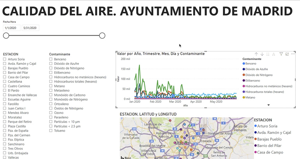
What is an interactive display? Here is an example
The visual representation of data helps our brain to digest large amounts of information quickly and easily. Interactive visualizations make it easier for non-experts to analyze complex situations represented as data.
As we introduced in our last post on this topic, graphical data visualization is a…
The use of open data in the tourism sector
When planning our vacations, we all look for the perfect destination that meets our expectations: beach, mountain, city... But once we have decided where to go, we still have to make many decisions: how am I going to organize my trip so that everything goes perfect? Luckily, we have hundreds of appl…
