Description
Geospatial data is one of the data categories most demanded by organizations, companies and citizens. The new European regulation on open data and reuse of public sector information considers them as high-value data, due to its ability to boost innovative services and generate socio-economic benefits in multiple sectors of activity.
When we talk about geospatial data, one of the main sources of data that comes to mind is COPERNICUS, the Earth observation program of the European Union.This program is led by the European Commission, with the collaboration of member states and various European agencies and organizations, such as the European Space Agency (ESA) and the European Environment Agency (EEA).

What is the Copernicus program?
Under the slogan “Europe's eye on Earth for the ultimate benefit of European citizens”, Copernicus collects, stores, combines and analyzes data obtained through two sources:
- Data obtained from satellite observation, through the constellations of Sentinel satellites and other third-party satellites.
- Data obtained by land, air and maritime in-siue sensor systems.
These data are organized through 6 servicesthat facilitate access to data and information: emergency, security, marine, land, climate change and atmosphere.

Based on these services, Copernicus has become the largest geospatial data provider in the world, with a current production of twelve terabytes per day. Most of these data - with the exception of those that may compromise citizen security - are provided free of charge and full through the DIAS services (cloud platforms that provide centralized access to Copernicus data and information) or through conventional data platforms.
This information is essential for decision-making in the new electronic government and digital economy systems, covering areas such as management and monitoring of sustainability, climate change and environment, transport, urban agenda and smart cities, security, emergency and catastrophe management, agriculture, energy and natural resources or blue economy, among many others. These data can also be combined with the data obtained through the GALILEO program,the European radionavigation and satellite positioning system. In this way, new opportunities for the public and private sector can be generated, while working towards the achievement of sustainable development goals.
The role of the Ministry of Development in the Copernicus Program
The Ministry of Development participates in the European Earth Observation Program COPERNICUS,as a national representative in various committees and forums, in addition to actively contributing to the provision of free and open data and services. Among others, it collaborates with the territory and marine services, through the D.G. of the National Geographic Institute (IGN) and State Ports.
Specifically, the IGN Territory Observation Unit exercises national representation, together with the Ministry for Ecological Transition (MITECO), in the Copernicus User Forum, for the monitoring and evolution of the program according to user requirements. The User Forum is the working group created to assist the Copernicus Committee to determine user requirements, verify service compliance and coordinate users in public sector. In turn, the Copernicus Committee in Spain is constituted by the Ministry of Industry, Commerce and Tourism and the Centre for Technological and Industrial Development (CDTI).
The IGN is also responsible for the national coordination of the Copernicus (Land) Service and the In Situ; Component; leads the European group of experts Copernicus In Situ EIONET Expert Group; and participates in the Copernicus Coordination Action Framework Program as a National Land Use Reference Center for the 2017-2021 period and the Copernicus User uPtake Framework Program (FP-CUP): 2018/2020.
In addition, it collaborates in the dissemination activities of the Copernicus Program in our country, such as Copernicus Relay and Academy.
Copernicus Relay y Academy
One of the purposes of the Copernicus program is to boost the economic opportunities of geospatial data. Through awards, hackathons, accelerators, e incubators, Copernicus want to help companies develop innovative ideas based on the reuse of the data they provide.
In addition, a set of networks called Copernicus Relay and Academy. were created in the first quarter of 2017to ensure some of the needs that the Copernicus program requires.
- Copernicus Relay
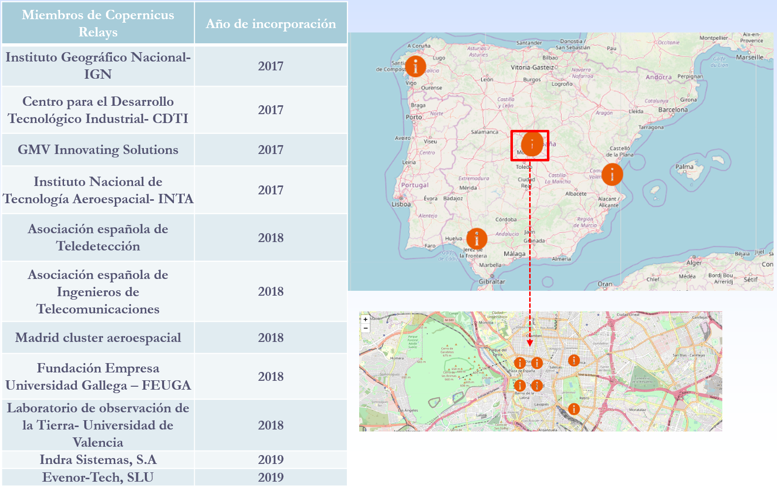
The Copernicus Relay are a group of organizations that coordinate and promote activities around the Copernicus program for local users and administrations in the field of Territory Observation. Its objective is to make known in Europe and outside Europe that Copernicus is a sustainable source of full, free and open information that meets the needs of national, regional and local public services, and that can function as a reinforcement for the development of services.
There are currently a total of 85 European Relay members of which 11 are Spanish. The IGN has been a member of Copernicus Relay since 2017.
The possible actions that can be developed by Copernicus Relay members are, among others:
- Coordinate activities at the local level
- Distribute Copernicus dissemination material.
- Inform about what Copernicus is and answer user questions.
- Perform and promote events to publicize Copernicus.
- Organize courses
Any organization that is well connected with user communities, such as private companies, research centers, universities and end users of the public or private sector, can participate. To be a member of Copernicus Relay it is necessary to make a request on this website.
- Copernicus Academy
The Copernicus Academy connect European universities, research institutions, business schools and private organizations of the countries participating in the program and beyond. The objective of the network is to link academic and research institutions with authorities and service providers, facilitating collaborative research and the development of conferences, training sessions and internships. It also provides educational and training material for researchers, scientists and entrepreneurs.
Copernicus Academy also works to increase ideas and good practices sharing across borders and disciplines, while contributing to the development of the use of Earth Observation data in general and Copernicus data and information in particular, in various organizations or industries of public or private users.
There are currently a total of 17 Academy members in Spain.
In short, through these and other initiatives it is expected that an increasing number of users will know the Copernicus program and boost the economic and social opportunities that it entails. Thanks to the accurate, up-to-date and easy-to-access information of the Copernicus program, we will be able to know our environment better, and make decisions that guarantee the future of all European and other regions citizens.
Content prepared based on information by Nuria Valcárcel, Deputy Assistant Director, D.G. National Geographic Institute. Ministry of development.
Podeis mostrar las imagenes del cumbre vieja de La palma?
Buenos días David,
El IGME ha preparado una web específica donde puede seguir la situación en Cumbre Vieja: https://bit.ly/39muBC2
Un cordial saludo,