Interview with Nuria Valcárcel: The Copernicus program in Spain
Fecha: 02-10-2019
Nombre: Nuria Valcárcel
Sector: Public sector
Organismo, Institución o Empresa: National Geographic Institute (IGN) of the Ministry of Development
Copernicus is the Earth observation program of the European Union. Through 6 thematic services, and the images provided by its satellites, Copernicus provides complete, free and up-to-date geospatial data that helps the monitoring and management of the territory and the planet both at European and worldwide level.
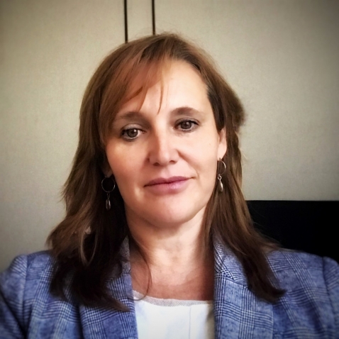
In datos.gob.es, we have interviewed Nuria Valcárcel, Deputy Assistant Director (Observation of the Territory) of the General Directorate of Geodesy and Cartography, in the D.G. National Geographic Institute (IGN) of the Ministry of Development, an organization that represents Spain in the Copernicus Users Forum, for the monitoring and evolution of the program, together with the Ministry for Ecological Transition (MITECO).
Earth observation data, such as those linked to the Copernicus project, always awaken great interest. What are the reasons?
Copernicus geospatial data are essential as a decision-making tool in the current digital economy and government systems. These data can be used to analyze and monitor phenomena due to climate change, and help us find solutions. Its potential is also enormous in matters related to safety, transportation, emergency management, sustainability assessment...
There are many organizations that, aware of the current context, have highlighted the importance of this initiative to achieve the Sustainable Development Goals (SDGs), such as the United Nations Organization or the European Commission. The United Nations, in its document “Transforming our world: the 2030 Agenda for Sustainable Development”, indicates that national institutions should promote the use of Earth observation data and geospatial information, to follow up on the 2030 Agenda.
Specifically, what kind of data and information does Copernicus provide?
Copernicus data has 2 large components: on the one hand, the information obtained via satellite, such as the Sentinel constellations, and on the other the in-situ component, that is, any data not coming from satellites. For example, air quality data, water quality data in rivers and reservoirs, wave and sea level information through buoys, tide gauges, orthophotographs and digital elevation models ... In the case of Spain, these data are provided by different national organizations such as IGN, MITECO, AEMET or State Ports, among others.
Through the Copernicus hub you can access and download these data. The information obtained through Sentinel satellites is available for use by any citizen, but when we talk about the rest of the on-site data, we find differences according to the data policy of each country. In the case of Spain, it should be noted that we have really been pioneers in open data policies and much of the information we generate is available through Copernicus' own download platforms or national platforms.
Who are the main users of this type of data? Could you give an example?
Public administrations are the main users of Copernicus, but an increasing number of companies rely on these data to generate new opportunities and improve their competitiveness, as well as universities and research centers.
The IGN and other Spanish administrations are beginning to work with large and small Spanish companies to collaborate in the generation of data for Copernicus, but we also try to boost its reuse more and more. For example, for water management or smart agriculture, since they facilitate continuous monitoring of the state of the crops, allowing water resources to be optimized. As a concrete example, we can talk about the DIANA Project, in which the company AGRISAT and the Andalusian Federation of Irrigation Communities of Andalusia (FERAGUA) participate, to generate an innovative commercial services platform, based on Copernicus Earth Observation data and other sources, for the identification of illegal irrigation areas and the estimation of volumes of water extracted.
Forest management can also greatly benefit from Sentinel satellites and Copernicus data. This is the case of AGRESTA and its FORESMAP application, which combine satellite data with others data sources such as the Lidar provided by the IGN, to provide an online forest inventory calculation. This application has been awarded at the 2018 Copernicus Masters CGI Big Data Business Challenge.
Another area with great potential is marine services, for the sustainable exploitation of coastal resources, port management, or the optimization and safety of trade routes. Here we can mention NOLOGIN as an example. It provide a (web and mobile) real time application and predictions for decision making in system ports, based on Copernicus data, with an alert and report management interface.
And regarding public administrations, do you know any AA.PP. that intensively use Copernicus project data?
There are many experiences. To highlight some examples, the IGN provides Copernicus data directly through the Download Center and makes extensive use and dissemination of Sentinel satellite images through the National Remote Sensing Plan. These data are also used by the IGN to enrich the system for monitoring changes in the terrain, for example, to assess volcanic risk.
The data of the marine operational service are very useful for State Ports. knowing how marine currents evolve, and improving their predictive models is possible thanks to them
For its part, AEMET participates in the generation of Copernicus data and services in relation to Atmosphere and Climate Change, as a member of the European Centre for Medium-Range Weather Forecasts, which benefits Spanish institutions and scientists participating in numerous research programs.
The Spanish Agricultural Guarantee Fund, the National Parks Network, the General Water Directorate, the Autonomous Communities, as well as a large number of universities and study centers also use these type of data.
What are the main challenges and barriers to the reuse of Earth observation data?
The challenges that reusers have to face could be summarized in 4 areas.
In the first place, some technical knowledge is required to work with Copernicus data. Although sometimes we find some data or services easy to use by non-expert users, in other cases advanced capabilities are needed to locate and understand the information. Copernicus Program is making an effort to train professionals, through free courses, while working on the creation of environments where data are easily located and easy to use.
Secondly, we could talk about the coordination between the different levels of European administration (local, regional, state ...). A common effort must be made to generate better data, avoiding duplication, and for this, coordination between European and national institutions is essential. Currently, there are coordination mechanisms already established, but there are areas for improvement.
Thirdly, it is necessary to improve the interaction with users, to better understand their needs and thus be able to assess whether the Copernicus program is responding to those needs. And these needs are changing and require constant adaptation. Through the Spanish Users' Committees and Forum, the National Services Coordinators, and the Relay and Academy Networks, we are making a strong effort to approach as many users as possible, to work together in a common goal.
Finally, we cannot forget the need to encourage data to be interoperable, to meet common standards and to be harmonized. For example, the Mediterranean coast, and the different phenomena and dynamics that affect it, have to be monitored as a whole, and for this we need a common pan-European data, also harmonized with the national data that each country manages. Again, coordination between administrations is essential to achieve this goal.
One of the challenges you have mentioned is the user´s lack of knowledge about Copernicus data availability. What concrete actions are the IGN taking to publicize Copernicus data?
The European Union organizes different activities to encourage the use of Copernicus data in private companies. This is the case of the Copernicus Master competition, hackathons, the acceleration programs (Copernicus Accelerator) or business incubation (Copernicus Incubator). These types of activities, often aimed at entrepreneurs and start-ups, seek to support new ideas that involve the creation of services and commercial applications related to Copernicus.
In addition, the IGN, together with the Ministry for Ecological Transition (MITECO), in the Copernicus Users Forum, and also with representatives in the Copernicus Committee (the Ministry of Industry, Commerce and Tourism and the Centre for Technological and Industrial Development), works very actively with the different user groups in Spain. We are part of the Copernicus Users Forum, we carry out meetings and workshops for specific services and themes (Territory, Marine, Agriculture, Smart Cities, etc.), we encourage the participation of universities in Copernicus activities and proposals… In short, we seeks to generate a favorable ecosystem that facilitates the use of Copernicus.
Finally, could you tell us what your future plans are?
The Copernicus program is open to continuous review of requirements. In this regard, I would highlight two issues on the agenda.
First, the synergies between Copernicus and Galileo, the European Union navigation system, that the Ministry of Development also lead in Spain. The integration of both systems allows real-time monitoring of atmospheric phenomena to determine how vehicles move in cities. In this way, the constant impact of greenhouse gas emissions from vehicles could be monitored. It could also be used in matters of security, surveillance of natural hazards, etc.
On the other hand, the European Commission is directing its policies towards sustainability and the fight against climate change. In the new Copernicus operating cycle (2021-2027), some of the areas to be promoted are the monitoring of greenhouse gases or the monitoring of Polar Regions (snow and ice level). The civil security approach will also be expanded and the use of Copernicus data will be encouraged not only in Europe, but also in other regions, such as Latin America or Africa.


