


Practical guide for the publication of Spatial Data


Fecha del documento: 08-06-2025

A spatial data or geographical data is that which has a geographical reference associated with it, either directly, through coordinates, or indirectly, such as a postal code. Thanks to these geographical references it is possible to locate its exact location on a map. The European Union includes spatial data among the datasets that can be considered of high value, due to their "considerable benefits for society, the environment and the economy, in particular due to their suitability for the creation of value-added services, applications and new jobs". There are many examples of the potential for re-use of this type of data. For example, the data provided by the Copernicus Earth Observation system has been used to create tools for monitoring areas susceptible to fire or to help stop drug trafficking. It is therefore important that spatial data is created in a way that facilitates its availability, access, interoperability and application.
A large amount of the open data managed by public administrations can be geo-referenced, thus maximising its value. To help public administrations publish this type of information in open format, this "Practical Guide to the Publication of Spatial Data" has been produced within the framework of the Aporta Initiative. It has been developed by Carlos de la Fuente García, an expert in open data, with the collaboration of the National Centre for Geographic Information (National Geographic Institute), as well as contributions and suggestions from a large number of experts in the field.
Who is the guide for?
The guide is primarily aimed at Open Data developers whose goal is to publish spatial data sets. It is preferable that the reader be familiar with basic knowledge about the fundamental elements that make up geospatial information, spatial context metadata and geographic web services.
What can I find in the guide?
The guide begins with a section that addresses the essential concepts needed to understand the nature of spatial data. This section includes explanations of the visual representation of geographic information, as well as details of the tools required for spatial data analysis and transformation, and the recommended formats and metadata. There are specific sections on Geographic Information Systems (GIS) and the role of geographic web services and Spatial Data Infrastructures (SDIs) in facilitating access to and management of geographic data sets and services is discussed.
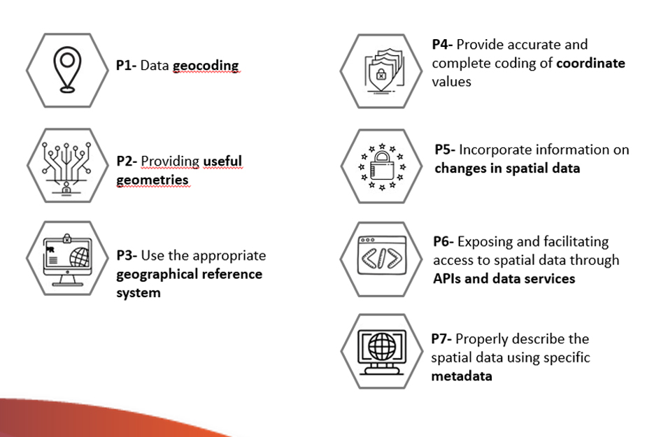
It then compiles a set of guidelines to facilitate the efficient publication of spatial data on the Internet, taking into account the international standards of the International Organization for Standardization (ISO). The guidelines detailed in this guide are:
Finally, a series of references, specifications, formats, standards and tools of direct application for the publication of Spatial Data are included.
The following elements are also included throughout the guide: references to the European INSPIRE Directive as a catalyst for sharing geographic resources in Europe and guidelines for describing spatial information derived from the Open Data metadata standards, DCAT and GeoDCAT-AP.
Other materials of interest
Although the primary scope of this document is oriented towards the publication of spatial data, it should not be forgotten that the application of all good practices linked to data quality in general is essential for their effective re-use. In this sense, it is advisable to complement this guide with the reading and application of other guides that provide guidance on the application of guidelines to ensure the publication of structured quality data, such as the Practical Guide for the publication of tabular data in CSV files and or using APIs.
You can download the Practical Guide for the Publication of Spatial Data from the following links:


