


The Island Council of La Palma joins the datos.gob.es´ catalog


Fecha de la noticia: 24-09-2020
The open data catalogue of datos.gob.es is constantly growing. One of the latest additions is the Island Council of La Palma, which has recently federated almost 400 datasets. This action is part of its policies to promote the Open Government.
The Island Council of La Palma launched its data catalog in 2015, becoming one of the first open data portals in the Canary Islands. Its aim was to create a local and unified repository of data and applications of interest. For 5 years, La Palma Open Data has not stopped growing, and today has 87 active users and 77 work groups that help to enrich its open data ecosystem.
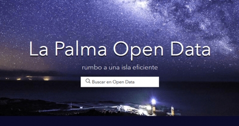
La Palma Open Data at a glance
The project is run by the Innovation, Projects and Information Society Service of the Island Council of La Palma, and is organised technologically around ESRI's ArcGis Online technology platform (AGOL). Each area of the Cabildo manages its own datasets and applications through the platform, at both public and private level.
The portal has been progressively opened up to different types of formats, and currently has a high number of reusable themes and formats (csv, shp, kml, geoson, htm). The datasets are organised into 10 categories:

Of all the datasets hosted on the portal, the ones that receive the most visits are those directly related to tourism and outdoor sports, such as the network of footpaths and the routes of Transvulcania, a famous ultra-marathon held on the island every year. The catalogue also incorporates real-time datasets from IoT devices, related to weather and air quality stations.
Focus on reuse and use cases
La Palma Open Data also has an outstanding section of applications and visualisations, which facilitate access to the data for those citizens who do not have the knowledge or time to work with raw data. Some examples of the most widely used applications are:
- Transvulcania mountain race.
- Covid19 impact on the island of La Palma, with information, maps and official resources on the coronavirus COVID-19 on the island of La Palma.
- Network of footpaths, with different routes to enjoy nature.
- Meteo La Palma, an application that generates weather maps in real time and whose data are dumped into a public database.
- Waste, developed by the Island Service Consortium, with the distribution of clean points and containers.
- Public lighting, an application with the distribution and characteristics of all the island's public lighting.
To make it easier for any user to download the data and build their own applications, La Palma Open Data focuses on open standards, interoperability and downloading data via APIs.
In addition, the Cabildo periodically organises activities to promote reuse, such as hackathons, awards and open data conferences. They are currently working on new post-Covid19 editions.
Next steps
As we have seen, La Palma Open Data is an initiative that is constantly evolving, incorporating new features to adapt to the needs of users. Within the framework of the Smart Island project, its aim is to continue to promote the use of open data with the focus on real-time data from IoT devices.
Do you want to know more about La Palma Open Data? Visit their datasets in our catalog.


