MetroMinuto APP
Share


Publication date: 06-06-2024
URL to data source catalogue/s: https://abertos.xunta.gal/busca-de-datos?langId=es_ES
Author/Developer: Pumpún Dixital
Platform:
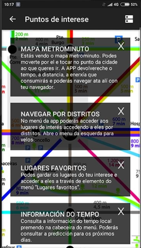
Metrominuto is an application that provides its users with information on distances and times between the most important points of Pontevedra. It does this through a synoptic map, imitating the design of subway maps, installed in the city signage and also consultable through a mobile application. Among the app's functions, the following stand out:
- Provides information on the distance, time and calories needed to reach a place in the city from the starting point according to the user's location.
- Includes expanded information on points of interest on the map.
- Proposes itineraries according to categories such as hiking, bicycle route, special routes, etc.
- Allows to classify places as favorites.
- It offers the user the possibility of pointing out mobility problems on the route.
Metrominuto operates in the city of Pontevedra and uses information from its open data portal.