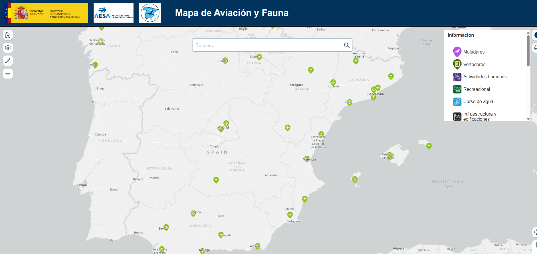
Aviation and wildlife map


Publication date: 11-04-2025
URL to data source catalogue/s: https://valencia.opendatasoft.com/pages/home/?flg=es-es, https://www.sedecatastro.gob.es/
Author/Developer: Ministerio de Transportes y Movilidad Sostenible. Agencia Estatal de Seguridad Aérea
This map is intended to provide information on wildlife that could affect air operations. In addition, it offers a flight route planning tool, which allows identifying areas with presence or concentration of fauna, which represent a risk for aviation. It is aimed at both commercial aviation users (airlines, airport operators, air navigation service providers, among others) and pilots and general aviation companies.
The map is based on data obtained from studies on wildlife and habitats, as well as animal collision risks, carried out by airport managers. It includes the main wildlife hotspots, especially birds, in and around airports; the species of greatest relevance to air operations; and information on their movements, where available.
It also includes the mapping of protected areas in Spain, provided by the Ministry for Ecological Transition and the Demographic Challenge, as well as data on landfills, dunghills, wetlands, among others, provided by the autonomous communities.
A new version of the map has recently been launched, incorporating updated open data from AESA, the Ministry for Ecological Transition and the Demographic Challenge, airport managers and the autonomous communities.