


Website
-
 QEDU
22-07-2025
QEDU
22-07-2025
QEDU, what to study and where at university, is an application that offers information to the population that is thinking of accessing university. QEDU collects knowledge about the degrees taught in Spanish universities and offers multiple data on them,...
-
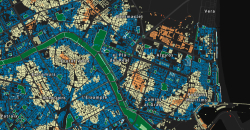
 GEOCODE
15-07-2025
GEOCODE
15-07-2025
Geocode is a tool designed to improve the quality of company databases and facilitate information management. This geocoding service makes it possible to obtain the cadastral reference associated with electricity supply points. This service involves...
-
 IDDIGO, city answer provider
07-07-2025
IDDIGO, city answer provider
07-07-2025
IDDIGO – Advanced Observatory of Cities and Territories is a technological platform designed to store and manage behavioral and performance variables and indicators of urban municipalities and territories in their various areas. Additionally, it offers...
-
 More data cancer
10-06-2025
More data cancer
10-06-2025
More Cancer Data is an initiative that brings together 24 scientific organisations and patient associations, with the aim of developing an integrated model of knowledge about cancer. This project makes 69 key indicators available to the public, organised...
-
 12-04-2023
Esta página web permite consultar las tarifas de la luz en España. Los usuarios pueden conocer el precio de la luz de hoy por horas, tramos, evolución por horas, semanas, meses o año. Los precios se actualizan diariamente y a las 21h puedes conocer...
-
 CO2 Alert
06-05-2025
CO2 Alert
06-05-2025
The app makes it possible to visualise CO₂ levels in real time and act in advance. To do so, they use Internet of Things (IoT) technology, artificial intelligence, Big Data, Geographic Information Systems (GIS), digital twin and open data. The platform...
-
 Aviation and wildlife map
11-04-2025
Aviation and wildlife map
11-04-2025
This map is intended to provide information on wildlife that could affect air operations. In addition, it offers a flight route planning tool, which allows identifying areas with presence or concentration of fauna, which represent a risk for aviation. It...
-
 01-04-2025
El indicador permite visibilizar la vulnerabilidad de distritos municipales, secciones censales y manzanas, en una cifra a partir de la valoración ponderada de 50 variables que afectan a cada individuo residente en esa delimitación en Zaragoza en...
-
 Map of green spaces Valencia
26-03-2025
Map of green spaces Valencia
26-03-2025
This journalistic piece published by À Punt includes a dynamic map elaborated with the geospatial open data offered by Open Street Map that represents the distance in approximate time in which each neighbourhood is located from a green space. In other...
-
 Air quality in Alcobendas
10-03-2025
Air quality in Alcobendas
10-03-2025
This Power BI dashboard provides historical data on air quality in the municipality of Alcobendas by day and hour, taking into account the Air Quality Index (AQI) marked by the Ministry of Ecological Transition, ie: Good Reasonably...


