Catrastro App
Share


Publication date: 06-05-2024
URL:
URL to data source catalogue/s: https://www.sedecatastro.gob.es
Author/Developer: Ministerio de Asuntos Económicos y Transformación Digital
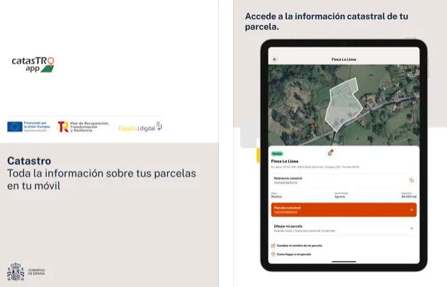
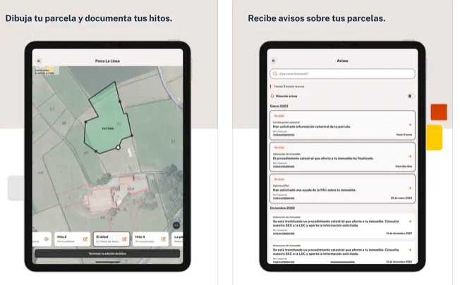
The application allows citizens to gather information about their properties, as well as to personalize it with the photographs and annotations they need for its correct location on the territory. It also allows them to receive alerts if any cadastral alteration affects one of their properties.
The functionalities of the app are:
- Interactive Map Query: View plots in detailed interactive maps.
- Draw Plots: Locate plots easily on the territory saving all the necessary information for its location.
- Record Detailed Parcel Information: Add essential information such as names, photographs, boundary information, land use and more.
- Capture Images: Add images to parcels to easily identify parcel boundaries or landmarks to find the parcel.
- Download the generated documentation: Download to your cell phone a document with the plot drawing, photographs and all the recorded information. This documentation will be saved in the application in each device and will be available for download at any time.
- Receive cadastral notices: Protect the properties by knowing instantly any cadastral alteration that may affect them.
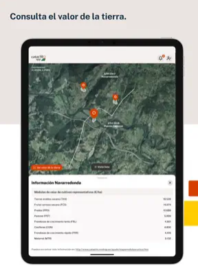
- Land prices: The Cadastre reports the average price of the most representative crops or uses in each area.
Access available to all the information thanks to the open data of the cadastre.