5 posts found
Building footprints: open data that saves lives in emergencies
In a world increasingly exposed to natural hazards and humanitarian crises, accurate and up-to-date geospatial data can make the difference between effective response and delayed reaction. The building footprints, i.e. the contours of buildings as they appear on the ground, are one of the most valua…

Open geographic data applications of the National Centre for Geographic Information (NICHD)
The National Centre for Geographic Information publishes open geospatial data from the National Cartographic System, the National Geographic Institute and other organisations through web applications and mobile applications to facilitate access to and consultation of geographic data by citizens.
Geo…

What is the value of open geographic data?
Geographic data allow us to learn about the world around us. From locating optimal travel routes to monitoring natural ecosystems, from urban planning and development to emergency management, geographic data has great potential to drive development and efficiency in multiple economic and social area…

Back to School: Readings on Open Data and New Technologies
Summer is coming to an end. August is winding down, and September is on the horizon, bringing with it the return to routine and all that it entails. The start of the school year and the end of vacations can be challenging. However, this time of year, along with January, is a time for fresh beginning…

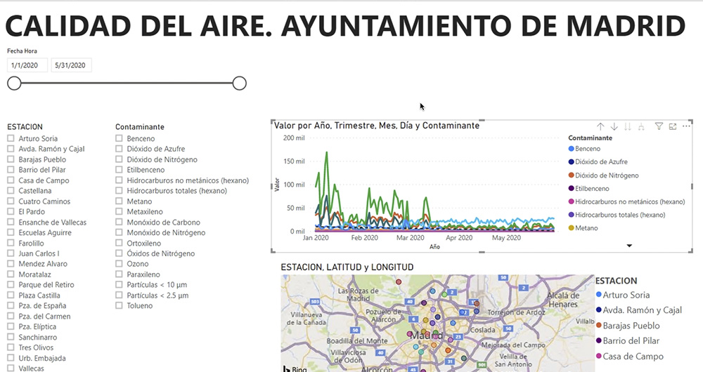
What is an interactive display? Here is an example
The visual representation of data helps our brain to digest large amounts of information quickly and easily. Interactive visualizations make it easier for non-experts to analyze complex situations represented as data.
As we introduced in our last post on this topic, graphical data visualization is a…