Description
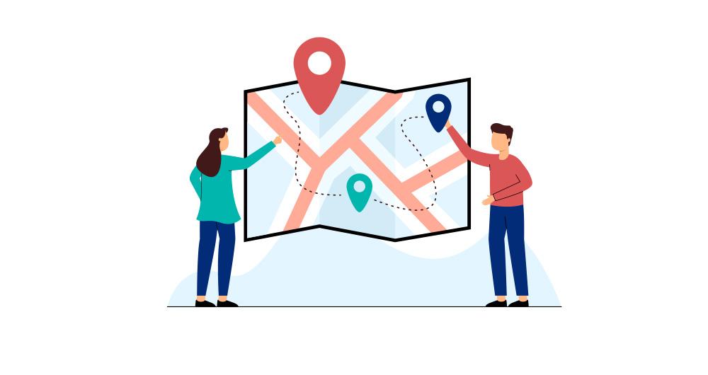
Maps help us to understand the world in which we live and have therefore been fundamental in the development of humanity. They allow us to know the characteristics of a place and to understand social phenomena, such as the spatial behaviour of a disease or the traceability of trade flows.
If we show data through a map, we facilitate its understanding and interpretability. But in order to build such geospatial visualisations, we need georeferenced data.
What is georeferencing?
Georeferencing is a method of determining the position of an element based on a spatial coordinate system.
Much of the open data offered by public administrations is geo-referenced or can be geo-referenced, thus increasing its value. Through geo-referenced online services for viewing or downloading data such as Spatial Data Infrastructures (SDI) or geoportals, users can access a large amount of such data. But handling this type of information is not easy.
The user of georeferenced data needs to understand key concepts linked to the visualisation of geographic information such as coordinate reference systems, cartographic projections or the different data representation models with which they work: raster - pixel map images - or vector - points, lines, etc. representing different objects. These elements can be combined with each other on Geographic Information Systems (GIS).
This article includes a set of useful tools to tackle the tasks necessary to develop geospatial data visualisations, as well as libraries based on different programming languages for geographic information processing.
Geospatial visualisation tools
Carto
Functionality:
Carto is a geospatial data analysis platform, aimed at developers with no previous experience in geospatial information systems, which facilitates the creation of geolocated interactive applications.
Main advantages:
Its main advantage is that it allows the design and development of real-time maps that work on web platforms and mobile devices. It also allows linking with cartographic services such as Google Maps or MapBox, so that some of their functionalities, such as zoom or scrolling, can be used.
By using the PostGIS library, Carto allows querying and combining geospatial datasets, and CartoCSS can be used in the data layers to easily edit the format and appearance of the maps.
Do you want to know more?
- Support Materials: On its website, Carto offers user manuals, both for users who want to use the platform for spatial analysis and for those who want to develop apps using its suite of tools. It also offers tutorials for managing the account or configuring security, regular webinars with practical examples, a blog and various videos on its YouTube channel.
- Repository: On Github we find a multitude of repositories with resources for Carto.
- User community: Users can get in touch via Stackoverflow.
- Social media: You can keep up to date with Carto's news by following its profile on Twitter (@CARTO) or LinkedIn.
OpenLayers
Functionality:
OpenLayers is the open source JavaScript library that allows the inclusion of map-like components in any web page.
Main advantages:
OpenLayers allows you to overlay different layers and add different features such as points, lines, polygons and icons on which to link a legend. It incorporates a set of basic controls and a toolbar of advanced controls, which allows the necessary functionality to be embedded using the API. It also excels at rendering DOM elements anywhere on the map.
Do you want to know more?
- Support materials: On the OpenLayers website there is a user manual that quickly explains how to put a simple map on a web page, or more advanced guides on the different components. There are also tutorials available that cover basic concepts, the background of OpenLayers or how to create an application. Outside of their website you can also find other helpful resources, some of which are listed in this article. If you are a beginner, we also recommend this video that explains basic functionalities in just 12 minutes.
- User community: If you want to know the experience of other users, and ask any questions, you can go to Stackoverflow.
- Social media: On their Twitter channel (@openlayers) you can participate in polls or find out related news. They also have a LinkedIn group.
OpenStreetMap
Functionality:
OpenStreetMap is a collaborative project focused on the creation of free, editable maps. These maps are created using geographic information captured with GPS devices, orthophotos and other public domain sources.
Main advantages:
Registered OpenStreetMap users can upload their GPS tracks, create and correct vector data using community-created editing tools. It also stands out because it uses a topological data structure that is stored in the WGS84 lat/lon (EPSG:4326) datum as a coordinate reference system.
Do you want to know more?
- Support materials: In this wiki you can find information on how to use OpenStreetMap or a beginner's guide on how to start contributing. Video tutorials are also available.
- Repository: On Github there are several repositories and resources for further progress in the creation of maps.
- User community: OpenStreetMap has an official support forum, although users also have a meeting point on Stackoverflow.
- Social media: For news and trends, you can follow the Twitter account @openstreetmap or its LinkedIn profile.
Geographic information processing tools
Although these are not geospatial visualisation tools per se, it is worth highlighting the existence of libraries of different programming languages designed for the processing of geographic information.
Geocoder and Geopy:
Functionality:
Geocoder and Geopy are Python libraries designed to solve the geocoding problem. They convert postal addresses into spatial coordinates or vice versa.
Main advantages:
Both libraries incorporate the ability to calculate the distance between geolocated points.
Do you want to know more?
- Support materials: Users who want to work with Geopy, have at their disposal this manual that includes the installation, the use of different geocoders or how to calculate distances, among other things. If you prefer Godecoder, in this guide you will find how to install it and examples of its use.
- Repository: On Github there are repositories with resources for both Geopy and Geocoder.
- User community: En Stackoverflow puedes encontrar grupos de usuarios de Geopy y Geocoder.
GDAL
Functionality:
GDAL is an open source library available for different programming languages such as Python, Java, Ruby, VB6, Perl and R.
Main advantages:
This library allows the translation between vector and raster geospatial data. A good number of tools that incorporate Geographic Information System (GIS) functions, such as PostGIS, Carto or ArcGIS, integrate GDAL to carry out this process.
Do you want to know more?
- Support materials: In this user manual you can find frequently asked questions and information about software and drivers. You can complement your reading with this tutorial.
- Repository: You can download everything you need to use it from Github.
- User community: Once again, it is on Stackoverflow where we find different open discussions about this tool.
- Social media: The @GdalOrg profile shares news of interest to all its users.
PROJ.4 and PROJ4.JS
Functionality:
PROJ.4 is a library available for several platforms, such as Ruby, Rust, Go or Julia, among others. PROJ4.JS is the implementation of PROJ.4 for JavaScript.
Main advantages:
PROJ.4 allows the transformation of geospatial coordinates from one coordinate reference system to another, as well as command line invocation for easy conversion of coordinates into text files.
Do you want to know more?
- Support materials: This manual includes information on cartographic projection, geodetic transformation or the known differences between versions, among other aspects
- Repository: On GitHub there is a space for PROJ.4 and another for PROJ4.JS.
- User community: On Stackoverflow there are also PROJ.4 and PROJ4.JS discussion groups.
The following table gives an overview of the tools mentioned above:

The criteria chosen to select these tools was their popularity, but we would like to know your opinion. Do not hesitate to leave us a comment.
These tools are included in the recently updated report "Data processing and visualisation tools". You can see more tools related to this field in the following monographs:
Content prepared by the datos.gob.es team.


Hola, soy historiador, nunca he utilizado ninguna herramienta de visualización geoespacial y mis conocimientos de programación son = 0. Querría saber si me podrían recomendar una aplicación que ya tenga mapas de España o de las comunidades autónomas con sus distintos municipios y que me permita utilizar una paleta de colores para visualizar porcentajes distintos (alfabetización , renta, población, tamaño), todos datos muy simples. Agradeciendo su atención.
Buenos días,
Con el paquete gratuito Geo Da puede realizar ud análisis geoestadísticos. Yo lo he utilizado durante la pandemia de la Covid19 para analizar datos sobre contagios en mi zona de trabajo. En mi caso concreto las matrices de datos geográficos las encontré en la web del Departament de Salut de la Generalitat de Cataluña i/o en la web del Idescat. Me imagino que podrá ud encontrar estos mismos archivos sobre España en el INE.
El paquete Geo Da lo puede encontar en https://geodacenter.github.io/download
Os recomiendo pasaros por nuestra web, también tenemos herramienta de visualización geoespacial con código abierto.
https://terre3.es/
Parece que entre las herramientas se ha apostado por herramientas web (no software de escritorio), si ese es el criterio, creo que se debería añadir:
A herramientas de visualización el ArcGIS Map Viewer (https://www.arcgis.com/apps/mapviewer/index.html) y Scene Viewer (https://www.arcgis.com/home/webscene/viewer.html), dado que ambos también se ofrecen en versiones gratuitas. Comparto un vídeo corto mostrando algunas de las posibilidades de esta herramienta: https://www.youtube.com/watch?v=ItBeABgi1fY&t=32s // la cuenta gratuita se puede crear en https://developers.arcgis.com/sign-up.
El visor de mapas clásico además permite no sólo visualizar sino también hacer análisis espacial (con versión gratuita tb): https://www.arcgis.com/home/webmap/viewer.html
Por otro lado, OpenStreetMap más que una herramienta de visualización es una gran base de datos geolocalizados.
Comparto una página con una ingente cantidad de recursos por si sirve: https://github.com/sshuair/awesome-gis
Si puedo ayudar con algo en este tipo de artículos... mi usuario de twitter es @hhkaos ^_^
Estimado:
Muchas gracias por la recomendación, lo tendremos en cuenta para próximos contenidos. En este artículo, hemos querido ceñirnos a herramientas desarrolladas en el ámbito del software abierto.
Un cordial saludo,
datos.gob.es
¡Hola! Muchas gracias por la información. Creo que falta una herramienta esencial en el tratamiento de datos y su análisis: ArcGIS de Esri. Sin duda, la más extendida a nivel AA.PP. y empresas por capacidades de análisis geográfico avanzado, más allá de la visualización.
Un saludo!
Estimado:
Muchas gracias por la recomendación, lo tendremos en cuenta para próximos contenidos. En este artículo, hemos querido ceñirnos a herramientas desarrolladas en el ámbito del software abierto.
Un cordial saludo,
datos.gob.es