


Applications
Category
- (-) Remove Environment filter Environment (14)
- Education (1) Apply Education filter
- Healthcare (1) Apply Healthcare filter
- Science and technology (1) Apply Science and technology filter
- Tourism (1) Apply Tourism filter
- Town planning and infrastructures (1) Apply Town planning and infrastructures filter
- Transport (1) Apply Transport filter
Platform
Tag
Publication date
- (-) Remove Last year filter Last year (14)
Sort by:
-
Map viewers for eclipses visible in Spain in 2026, 2027, and 2028
 Centro Nacional de Información Geográfica (CNIG)
The National Geographic Institute has made available to the public an interactive visualizer, with official astronomical information on the next eclipses that can be seen from the Iberian Peninsula: Total Solar Eclipse on August 12, 2026 Total...
-
Environmental Indicators Panel
 Instituto Nacional de Estadística (INE)
The Environmental Indicators Panel allows Spain's progress towards ecological transition to be monitored, tracking various objectives in areas such as climate change, material consumption and productivity, waste, energy, emissions, environmental taxation...
-
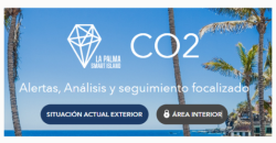
CO2 Alert
 Cabildo de la Palma
The app makes it possible to visualise CO₂ levels in real time and act in advance. To do so, they use Internet of Things (IoT) technology, artificial intelligence, Big Data, Geographic Information Systems (GIS), digital twin and open data. The platform...
-
CHEST
 Pablo García Zarza
CHEST (Cultural Heritage Educational Semantic Tool) is an application to support the creation and reuse of educational experiences related to cultural heritage around the world. The aim is to enable teachers to use the information to carry out activities...
-
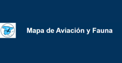
Aviation and wildlife map
 Ministerio de Transportes y Movilidad Sostenible. Agencia Estatal de Seguridad Aérea
This map is intended to provide information on wildlife that could affect air operations. In addition, it offers a flight route planning tool, which allows identifying areas with presence or concentration of fauna, which represent a risk for aviation. It...
-
Map of green spaces Valencia
 Marta Galindo
This journalistic piece published by À Punt includes a dynamic map elaborated with the geospatial open data offered by Open Street Map that represents the distance in approximate time in which each neighbourhood is located from a green space. In other...
-
Air quality in Alcobendas
 City council of Alcobendas
This Power BI dashboard provides historical data on air quality in the municipality of Alcobendas by day and hour, taking into account the Air Quality Index (AQI) marked by the Ministry of Ecological Transition, ie: Good Reasonably...
-
Garbiñe AI
 Beatriz Arenal Redondo
Garbiñe AI is an intelligent assistant that combines artificial intelligence (AI) with open data from Open Data Euskadi to promote the circular economy and increase recycling rates. The web application proposes a simple interface through which...
-
Hidroalerta
 Miguel Sala
Hidroalerta is an interactive map that provides real-time information on the flow of rivers and wadis, the volume of water in reservoirs and rainfall in the Valencian Community. It is accessible in web and mobile versions. Through an...
-
AQI Air Quality Index
 Ministerio para la Transformación Digital y Función Pública
The National Air Quality Index (ICA) application shows, in real time and in a simple way, the information recorded by the air quality measurement stations throughout Spain. The user can consult hourly data communicated by the monitoring networks...


