11 posts found
How to ensure the authenticity of satellite imagery
Synthetic images are visual representations artificially generated by algorithms and computational techniques, rather than being captured directly from reality with cameras or sensors. They are produced from different methods, among which the antagonistic generative networks (Generative Adversarial…

The keys to the UNE data specifications
We live in a constantly evolving environment in which data is growing exponentially and is also a fundamental component of the digital economy. In this context, it is necessary to unlock its potential to maximize its value by creating opportunities for its reuse. However, it is important to bear in…

UNE 0081 Specification - Data Quality Assessment Guide
Today, data quality plays a key role in today's world, where information is a valuable asset. Ensuring that data is accurate, complete and reliable has become essential to the success of organisations, and guarantees the success of informed decision making.
Data quality has a direct impact not only…

Aplicación de la Especificación UNE 0079:2023 de gestión de calidad a los datos abiertos
Continuamos en esta segunda entrega de la serie de artículos con la aplicación de las especificaciones UNE. Antes de nada, recordemos que las Especificaciones UNE 0077, UNE 0078 y UNE 0079 introducen las buenas prácticas en el gobierno del dato, gestión del dato y gestión de calidad del dato con una…

Aplicación de las Especificación UNE 0078: 2023 a los datos abiertos
Este artículo constituye la tercera y última entrega de la serie de artículos dedicados dedicado a la aplicación de las especificaciones UNE de Gobierno, Gestión y Gestión de la calidad del dato a la publicación de datos abiertos. Recordemos que lo estamos realizando, aplicándolo al caso ficticio de…

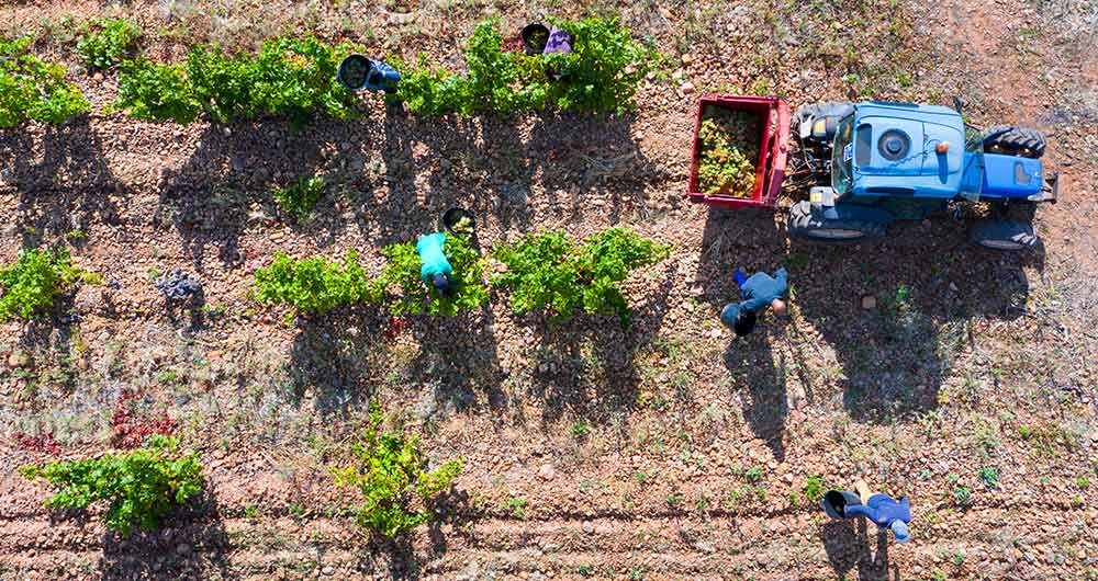
The benefits of open data in the agriculture and forestry sector: the case of Fruktia and Arbaria
As in other industries, digital transformation is helping to change the way the agriculture and forestry sector operates. Combining technologies such as geolocation or artificial intelligence and using open datasets to develop new precision tools is transforming agriculture into an increasingly tech…
Copernicus, the European Earth Observation Program
Geospatial data is one of the data categories most demanded by organizations, companies and citizens. The new European regulation on open data and reuse of public sector information considers them as high-value data, due to its ability to boost innovative services and generate socio-economic benefit…
The agroclimatic information system for irrigation (SiAR)
The data generated by the agroclimatic stations maintained by the different public administrations and integrated into the Agroclimatic Information System for Irrigation (SiAR) generate valuable open data sets for the agricultural sector. These data, combined with other open data sets, such as weath…
The transversality of open climate data
Humans have been interested in weather prediction for several millennia. This interest goes back at least until the Babylonian civilization, when meteorological predictions were already made based on astrology and the clouds patterns. However, it was in the early twentieth century when decisive prog…

Technologies that boost the precision forestry industry
The forest industry, as defined by FAO, include all economic activities that mostly depend on the production of goods and services from forests. This is an industry that, in many cases, has been seen as destructive to the environment due to its relationship with the tree felling. However, in almost…
