17 posts found
OGP's assessment and challenges ahead of the forthcoming Global Summit in Spain
The international open government community is preparing for the 9th Global Summit of the Open Government Partnership (OGP), which will take place in Vitoria-Gasteiz next October.. For three days, government representatives, civil society leaders and policy makers from around the world will exchange…

Open geographic data applications of the National Centre for Geographic Information (NICHD)
The National Centre for Geographic Information publishes open geospatial data from the National Cartographic System, the National Geographic Institute and other organisations through web applications and mobile applications to facilitate access to and consultation of geographic data by citizens.
Geo…

Open data to drive energy efficiency and sustainability
The promotion of energy efficiency and sustainability is one of the priorities of the European Union and Spain, as reflected in the European Green Pact. The availability of open data related to energy production, distribution and consumption allows governments, businesses and citizens to access…

What is the value of open geographic data?
Geographic data allow us to learn about the world around us. From locating optimal travel routes to monitoring natural ecosystems, from urban planning and development to emergency management, geographic data has great potential to drive development and efficiency in multiple economic and social area…

The importance of Critical Minerals: Where to locate data of interest?
The energy transition is also a transition of raw materials. When we imagine a sustainable future, we conceive it based on a series of strategic sectors such as renewable energies or electric mobility. Similarly, we imagine a connected and digital future, where new innovations and business models re…

Our first digital navigation. Open source alternatives to Google Maps
In the vast technological landscape, few tools have made as deep a mark as Google Maps. Since its inception, this application has become the standard for finding and navigating points of interest on maps. But what happens when we look for options beyond the ubiquitous map application? In this post w…

Emerging Trends in Geospatial Data and AI
On September 8, the webinar \"Geospatial Trends 2023: Opportunities for data.europa.eu\" was held, organized by the Data Europa Academy and focused on emerging trends in the geospatial field. Specifically, the online conference addressed the concept of GeoAI (Geospatial Artificial Intelligence), whi…

Open data for AI: UNESCO recommendations on open data
The UNESCO (United Nations Educational, Scientific and Cultural Organization) is a United Nations agency whose purpose is to contribute to peace and security in the world through education, science, culture and communication. In order to achieve its objective, this organisation usually est…

Hot OSM: Collaborative mapping to coordinate emergency response
The humanitarian crisis following the earthquake in Haiti in 2010 was the starting point for a voluntary initiative to create maps to identify the level of damage and vulnerability by areas, and thus to coordinate emergency teams. Since then, the collaborative mapping project known as Hot OSM (OpenS…

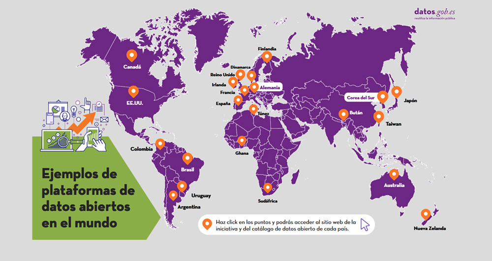
Trends in open data around the world
In view of the series of current and future trends around the future of open data indicated in our report, we wanted to check to what extent these - or similar - trends are already present in the global open data community. To this end, we have verified the current activities and future plans of sev…