9 posts found
GeoPackage in INSPIRE: efficiency and usability for geospatial data geospatial data.
In the field of geospatial data, encoding and standardisation play a key role in ensuring interoperability between systems and improving accessibility to information.
The INSPIRE Directive (Infrastructure for Spatial Information in Europe) determines the general rules for the establishment of an Inf…

How to measure carbon footprint using open data
The carbon footprint is a key indicator for understanding the environmental impact of our actions. It measures the amount of greenhouse gas emissions released into the atmosphere as a result of human activities, most notably the burning of fossil fuels such as oil, natural gas and coal. These gases,…

Accelerating the energy transition with open data
Aspects as relevant to our society as environmental sustainability, climate change mitigation or energy security have led to the energy transition taking on a very important role in the daily lives of nations, private and public organisations, and even in our daily lives as citizens of the world. Th…

A common language to enable interoperability between open dataset catalogs
Open data plays a relevant role in technological development for many reasons. For example, it is a fundamental component in informed decision making, in process evaluation or even in driving technological innovation. Provided they are of the highest quality, up-to-date and ethically sound, data can…

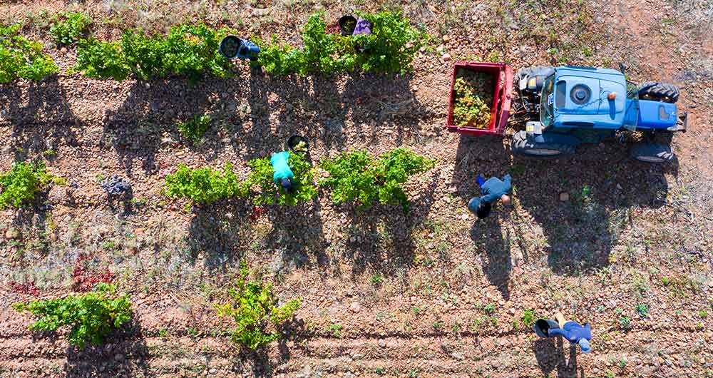
The benefits of open data in the agriculture and forestry sector: the case of Fruktia and Arbaria
As in other industries, digital transformation is helping to change the way the agriculture and forestry sector operates. Combining technologies such as geolocation or artificial intelligence and using open datasets to develop new precision tools is transforming agriculture into an increasingly tech…
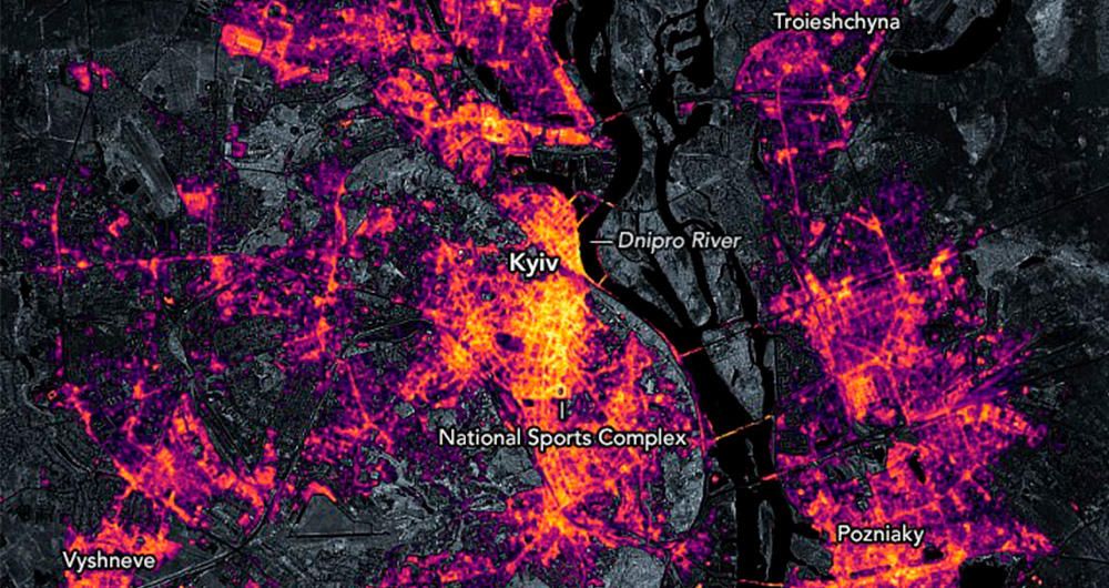
Collecting and analysing data to improve humanitarian assistance and restore damage during the Ukrainian war
On 24 February Europe entered a scenario that not even the data could have predicted: Russia invaded Ukraine, unleashing the first war on European soil so far in the 21st century.
Almost five months later, on 26 September, the United Nations (UN) published its official figures: 4,889 dead and 6,263…
Why should you use Parquet files if you process a lot of data?
It's been a long time since we first heard about the Apache Hadoop ecosystem for distributed data processing. Things have changed a lot since then, and we now use higher-level tools to build solutions based on big data payloads. However, it is important to highlight some best practices related to ou…
Most popular geospatial visualisation tools
Maps help us to understand the world in which we live and have therefore been fundamental in the development of humanity. They allow us to know the characteristics of a place and to understand social phenomena, such as the spatial behaviour of a disease or the traceability of trade flows.
If we sho…

How open data can help in the refugee crisis
According to the United Nations Agency for Refugees (UNHCR), we are currently witnessing the highest levels of displacement of people registered in recent history. In 2019, it is estimated that more than 70 million people have been forced to leave their homes, including 25.9 million legal refugees,…
